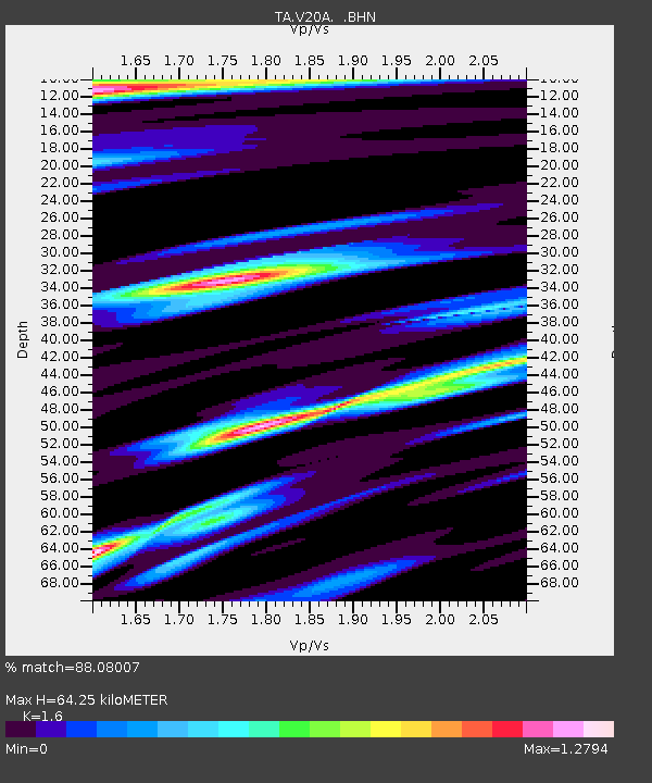
V20A Brimhall, NM, USA - Earthquake Result Viewer

Earthquake location: Andreanof Islands, Aleutian Is.
Earthquake latitude/longitude: 51.9/-179.2
Earthquake time(UTC): 2008/04/16 (107) 05:54:19 GMT
Earthquake Depth: 13 km
Earthquake Magnitude: 6.1 MB, 6.5 MS, 6.6 MW, 6.6 MW
Earthquake Catalog/Contributor: WHDF/NEIC
Network: TA USArray Transportable Network (new EarthScope stations)
Station: V20A Brimhall, NM, USA
Lat/Lon: 35.80 N/108.47 W
Elevation: 1889 m
Distance: 51.4 deg
Az: 78.926 deg
Baz: 311.552 deg
Ray Param: 0.067415446
Estimated Moho Depth: 64.25 km
Estimated Crust Vp/Vs: 1.60
Assumed Crust Vp: 6.496 km/s
Estimated Crust Vs: 4.06 km/s
Estimated Crust Poisson's Ratio: 0.18
Radial Match: 88.08007 %
Radial Bump: 400
Transverse Match: 78.89941 %
Transverse Bump: 400
SOD ConfigId: 2504
Insert Time: 2010-03-06 00:52:12.473 +0000
GWidth: 2.5
Max Bumps: 400
Tol: 0.001

Signal To Noise

ChannelStoNSTALTA
TA:V20A: :BHN:20080416T06:02:53.32501Z5.2831347.330702E-71.3875669E-7
TA:V20A: :BHE:20080416T06:02:53.32501Z1.68854534.551337E-72.6954189E-7
TA:V20A: :BHZ:20080416T06:02:53.32501Z1.16923212.6232487E-72.2435653E-7
Arrivals
Ps6.3 SECOND
PpPs24 SECOND
PsPs/PpSs30 SECOND