You are here: Home > Network List > CI - Caltech Regional Seismic Network Stations List
> Station BFS Mt Baldy Forest Station > Earthquake Result Viewer
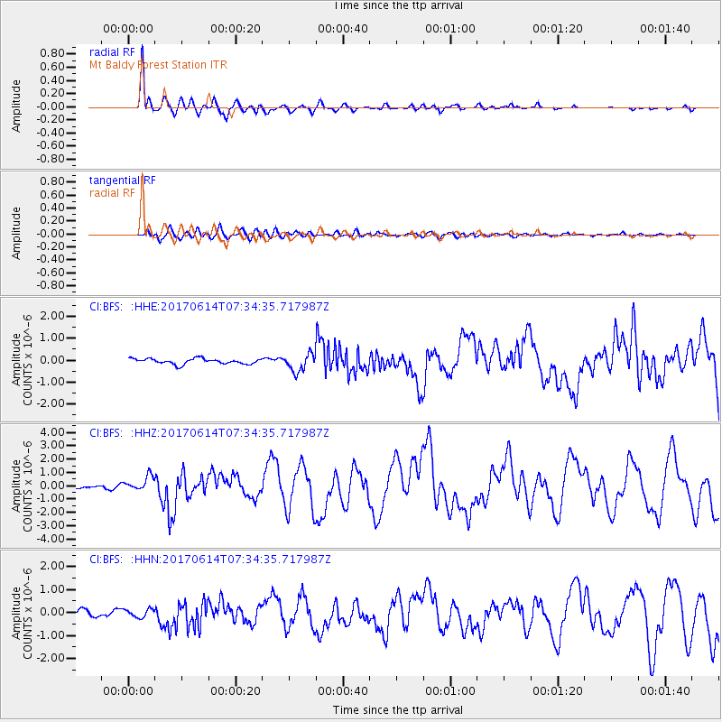
BFS Mt Baldy Forest Station - Earthquake Result Viewer
*The percent match for this event was below the threshold and hence no stack was calculated.
| Earthquake location: |
Near Coast Of Chiapas, Mexico |
| Earthquake latitude/longitude: |
14.9/-92.0 |
| Earthquake time(UTC): |
2017/06/14 (165) 07:29:03 GMT |
| Earthquake Depth: |
98 km |
| Earthquake Magnitude: |
7.0 Mi |
| Earthquake Catalog/Contributor: |
NEIC PDE/at |
|
| Network: |
CI Caltech Regional Seismic Network |
| Station: |
BFS Mt Baldy Forest Station |
| Lat/Lon: |
34.24 N/117.66 W |
| Elevation: |
1312 m |
|
| Distance: |
30.1 deg |
| Az: |
314.348 deg |
| Baz: |
123.433 deg |
| Ray Param: |
$rayparam |
*The percent match for this event was below the threshold and hence was not used in the summary stack. |
|
| Radial Match: |
88.66582 % |
| Radial Bump: |
400 |
| Transverse Match: |
65.97318 % |
| Transverse Bump: |
400 |
| SOD ConfigId: |
13570011 |
| Insert Time: |
2019-04-28 05:04:05.584 +0000 |
| GWidth: |
2.5 |
| Max Bumps: |
400 |
| Tol: |
0.001 |
|
Signal To Noise
| Channel | StoN | STA | LTA |
| CI:BFS: :HHZ:20170614T07:34:35.717987Z | 3.0856218 | 5.244023E-7 | 1.6995028E-7 |
| CI:BFS: :HHN:20170614T07:34:35.717987Z | 1.4927506 | 1.8287724E-7 | 1.2251024E-7 |
| CI:BFS: :HHE:20170614T07:34:35.717987Z | 2.6972902 | 3.323816E-7 | 1.2322798E-7 |
| Arrivals |
| Ps | |
| PpPs | |
| PsPs/PpSs | |


