V20A Brimhall, NM, USA - Earthquake Result Viewer
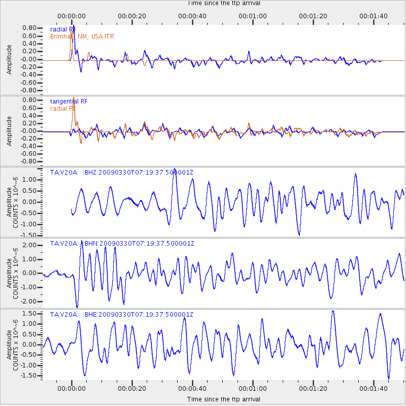
Earthquake location: Kodiak Island Region, Alaska
Earthquake latitude/longitude: 56.5/-152.7
Earthquake time(UTC): 2009/03/30 (089) 07:13:07 GMT
Earthquake Depth: 21 km
Earthquake Magnitude: 5.9 MB, 5.9 MS, 5.9 MW, 5.9 MW
Earthquake Catalog/Contributor: WHDF/NEIC
Network: TA USArray Transportable Network (new EarthScope stations)
Station: V20A Brimhall, NM, USA
Lat/Lon: 35.80 N/108.47 W
Elevation: 1889 m
Distance: 36.2 deg
Az: 105.939 deg
Baz: 319.072 deg
Ray Param: 0.07679797
Estimated Moho Depth: 54.5 km
Estimated Crust Vp/Vs: 2.10
Assumed Crust Vp: 6.496 km/s
Estimated Crust Vs: 3.097 km/s
Estimated Crust Poisson's Ratio: 0.35
Radial Match: 83.92203 %
Radial Bump: 360
Transverse Match: 59.701496 %
Transverse Bump: 376
SOD ConfigId: 2658
Insert Time: 2010-03-06 00:53:43.834 +0000
GWidth: 2.5
Max Bumps: 400
Tol: 0.001

Signal To Noise

ChannelStoNSTALTA
TA:V20A: :BHN:20090330T07:19:37.500001Z7.8181871.2729199E-61.6281523E-7
TA:V20A: :BHE:20090330T07:19:37.500001Z2.3054037.8664317E-73.4121723E-7
TA:V20A: :BHZ:20090330T07:19:37.500001Z2.37618027.8109974E-73.2872074E-7
Arrivals
Ps9.8 SECOND
PpPs24 SECOND
PsPs/PpSs34 SECOND