You are here: Home > Network List > TA - USArray Transportable Network (new EarthScope stations) Stations List
> Station V20A Brimhall, NM, USA > Earthquake Result Viewer
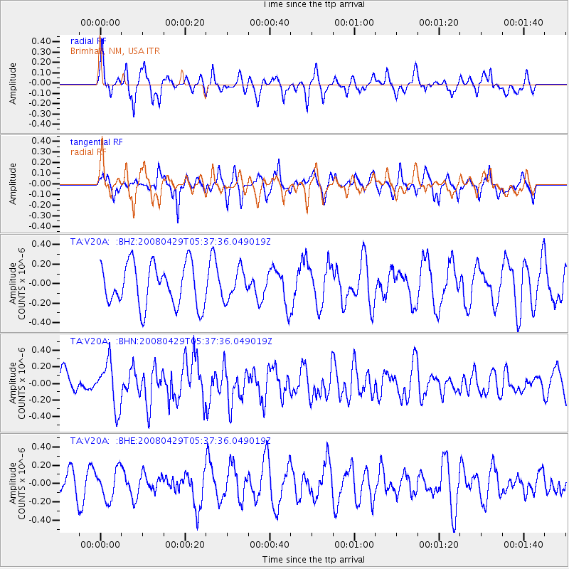
V20A Brimhall, NM, USA - Earthquake Result Viewer
*The percent match for this event was below the threshold and hence no stack was calculated.
| Earthquake location: |
Hokkaido, Japan Region |
| Earthquake latitude/longitude: |
41.5/142.0 |
| Earthquake time(UTC): |
2008/04/29 (120) 05:26:04 GMT |
| Earthquake Depth: |
47 km |
| Earthquake Magnitude: |
5.5 MB, 5.2 MS, 5.8 MW, 5.8 MW |
| Earthquake Catalog/Contributor: |
WHDF/NEIC |
|
| Network: |
TA USArray Transportable Network (new EarthScope stations) |
| Station: |
V20A Brimhall, NM, USA |
| Lat/Lon: |
35.80 N/108.47 W |
| Elevation: |
1889 m |
|
| Distance: |
79.6 deg |
| Az: |
51.17 deg |
| Baz: |
313.917 deg |
| Ray Param: |
$rayparam |
*The percent match for this event was below the threshold and hence was not used in the summary stack. |
|
| Radial Match: |
58.004005 % |
| Radial Bump: |
303 |
| Transverse Match: |
72.91703 % |
| Transverse Bump: |
301 |
| SOD ConfigId: |
2504 |
| Insert Time: |
2010-03-06 00:54:14.893 +0000 |
| GWidth: |
2.5 |
| Max Bumps: |
400 |
| Tol: |
0.001 |
|
Signal To Noise
| Channel | StoN | STA | LTA |
| TA:V20A: :BHN:20080429T05:37:36.049019Z | 2.1772182 | 2.8526674E-7 | 1.3102348E-7 |
| TA:V20A: :BHE:20080429T05:37:36.049019Z | 1.0599843 | 1.6666183E-7 | 1.5723047E-7 |
| TA:V20A: :BHZ:20080429T05:37:36.049019Z | 0.6985071 | 1.5026399E-7 | 2.1512162E-7 |
| Arrivals |
| Ps | |
| PpPs | |
| PsPs/PpSs | |


