You are here: Home > Network List > TA - USArray Transportable Network (new EarthScope stations) Stations List
> Station G21K Allakaket, AK, USA > Earthquake Result Viewer
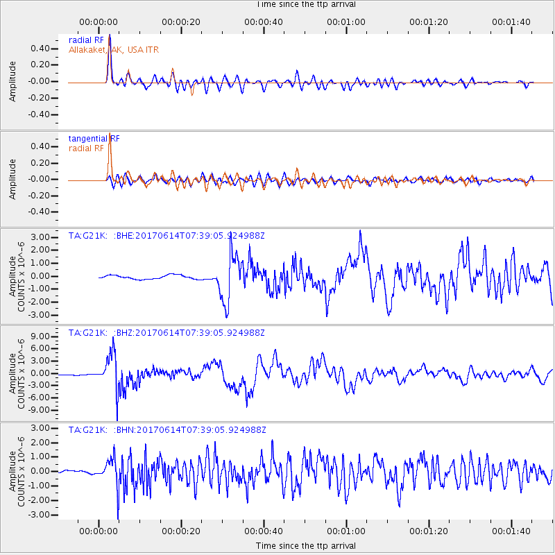
G21K Allakaket, AK, USA - Earthquake Result Viewer
*The percent match for this event was below the threshold and hence no stack was calculated.
| Earthquake location: |
Near Coast Of Chiapas, Mexico |
| Earthquake latitude/longitude: |
14.9/-92.0 |
| Earthquake time(UTC): |
2017/06/14 (165) 07:29:03 GMT |
| Earthquake Depth: |
98 km |
| Earthquake Magnitude: |
7.0 Mi |
| Earthquake Catalog/Contributor: |
NEIC PDE/at |
|
| Network: |
TA USArray Transportable Network (new EarthScope stations) |
| Station: |
G21K Allakaket, AK, USA |
| Lat/Lon: |
66.52 N/153.51 W |
| Elevation: |
446 m |
|
| Distance: |
65.2 deg |
| Az: |
337.177 deg |
| Baz: |
110.647 deg |
| Ray Param: |
$rayparam |
*The percent match for this event was below the threshold and hence was not used in the summary stack. |
|
| Radial Match: |
92.06569 % |
| Radial Bump: |
400 |
| Transverse Match: |
79.39224 % |
| Transverse Bump: |
400 |
| SOD ConfigId: |
13570011 |
| Insert Time: |
2019-04-28 05:09:12.307 +0000 |
| GWidth: |
2.5 |
| Max Bumps: |
400 |
| Tol: |
0.001 |
|
Signal To Noise
| Channel | StoN | STA | LTA |
| TA:G21K: :BHZ:20170614T07:39:05.924988Z | 47.903553 | 4.334505E-6 | 9.0483994E-8 |
| TA:G21K: :BHN:20170614T07:39:05.924988Z | 6.1779904 | 9.569882E-7 | 1.5490282E-7 |
| TA:G21K: :BHE:20170614T07:39:05.924988Z | 11.2599325 | 1.6941225E-6 | 1.5045583E-7 |
| Arrivals |
| Ps | |
| PpPs | |
| PsPs/PpSs | |


