You are here: Home > Network List > TA - USArray Transportable Network (new EarthScope stations) Stations List
> Station P17K Kvichak River, AK, USA > Earthquake Result Viewer
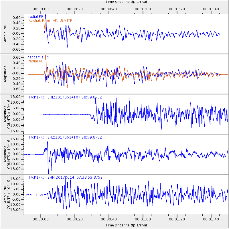
P17K Kvichak River, AK, USA - Earthquake Result Viewer
*The percent match for this event was below the threshold and hence no stack was calculated.
| Earthquake location: |
Near Coast Of Chiapas, Mexico |
| Earthquake latitude/longitude: |
14.9/-92.0 |
| Earthquake time(UTC): |
2017/06/14 (165) 07:29:03 GMT |
| Earthquake Depth: |
98 km |
| Earthquake Magnitude: |
7.0 Mi |
| Earthquake Catalog/Contributor: |
NEIC PDE/at |
|
| Network: |
TA USArray Transportable Network (new EarthScope stations) |
| Station: |
P17K Kvichak River, AK, USA |
| Lat/Lon: |
59.20 N/156.44 W |
| Elevation: |
91 m |
|
| Distance: |
64.3 deg |
| Az: |
328.984 deg |
| Baz: |
104.536 deg |
| Ray Param: |
$rayparam |
*The percent match for this event was below the threshold and hence was not used in the summary stack. |
|
| Radial Match: |
81.68199 % |
| Radial Bump: |
400 |
| Transverse Match: |
88.30072 % |
| Transverse Bump: |
400 |
| SOD ConfigId: |
13570011 |
| Insert Time: |
2019-04-28 05:10:22.575 +0000 |
| GWidth: |
2.5 |
| Max Bumps: |
400 |
| Tol: |
0.001 |
|
Signal To Noise
| Channel | StoN | STA | LTA |
| TA:P17K: :BHZ:20170614T07:38:59.875Z | 64.704666 | 6.4086635E-6 | 9.904484E-8 |
| TA:P17K: :BHN:20170614T07:38:59.875Z | 7.0495806 | 1.0518653E-6 | 1.4920963E-7 |
| TA:P17K: :BHE:20170614T07:38:59.875Z | 21.440142 | 3.476453E-6 | 1.6214692E-7 |
| Arrivals |
| Ps | |
| PpPs | |
| PsPs/PpSs | |


