You are here: Home > Network List > TA - USArray Transportable Network (new EarthScope stations) Stations List
> Station R33M Jennings River, BC, CAN > Earthquake Result Viewer
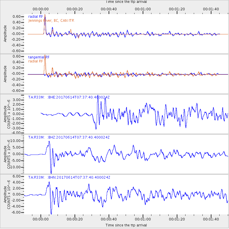
R33M Jennings River, BC, CAN - Earthquake Result Viewer
*The percent match for this event was below the threshold and hence no stack was calculated.
| Earthquake location: |
Near Coast Of Chiapas, Mexico |
| Earthquake latitude/longitude: |
14.9/-92.0 |
| Earthquake time(UTC): |
2017/06/14 (165) 07:29:03 GMT |
| Earthquake Depth: |
98 km |
| Earthquake Magnitude: |
7.0 Mi |
| Earthquake Catalog/Contributor: |
NEIC PDE/at |
|
| Network: |
TA USArray Transportable Network (new EarthScope stations) |
| Station: |
R33M Jennings River, BC, CAN |
| Lat/Lon: |
59.39 N/130.97 W |
| Elevation: |
1437 m |
|
| Distance: |
52.8 deg |
| Az: |
336.184 deg |
| Baz: |
130.272 deg |
| Ray Param: |
$rayparam |
*The percent match for this event was below the threshold and hence was not used in the summary stack. |
|
| Radial Match: |
95.10975 % |
| Radial Bump: |
371 |
| Transverse Match: |
84.28391 % |
| Transverse Bump: |
400 |
| SOD ConfigId: |
13570011 |
| Insert Time: |
2019-04-28 05:10:39.357 +0000 |
| GWidth: |
2.5 |
| Max Bumps: |
400 |
| Tol: |
0.001 |
|
Signal To Noise
| Channel | StoN | STA | LTA |
| TA:R33M: :BHZ:20170614T07:37:40.400024Z | 18.411913 | 3.8336675E-6 | 2.0821669E-7 |
| TA:R33M: :BHN:20170614T07:37:40.400024Z | 11.033435 | 1.6728634E-6 | 1.5161764E-7 |
| TA:R33M: :BHE:20170614T07:37:40.400024Z | 5.295971 | 1.0565473E-6 | 1.995002E-7 |
| Arrivals |
| Ps | |
| PpPs | |
| PsPs/PpSs | |


