You are here: Home > Network List > UW - Pacific Northwest Regional Seismic Network Stations List
> Station LEBA Lebam, WA, USA > Earthquake Result Viewer
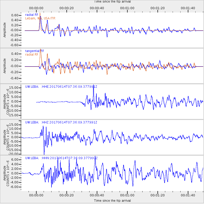
LEBA Lebam, WA, USA - Earthquake Result Viewer
*The percent match for this event was below the threshold and hence no stack was calculated.
| Earthquake location: |
Near Coast Of Chiapas, Mexico |
| Earthquake latitude/longitude: |
14.9/-92.0 |
| Earthquake time(UTC): |
2017/06/14 (165) 07:29:03 GMT |
| Earthquake Depth: |
98 km |
| Earthquake Magnitude: |
7.0 Mi |
| Earthquake Catalog/Contributor: |
NEIC PDE/at |
|
| Network: |
UW Pacific Northwest Regional Seismic Network |
| Station: |
LEBA Lebam, WA, USA |
| Lat/Lon: |
46.55 N/123.56 W |
| Elevation: |
73 m |
|
| Distance: |
41.1 deg |
| Az: |
326.668 deg |
| Baz: |
129.673 deg |
| Ray Param: |
$rayparam |
*The percent match for this event was below the threshold and hence was not used in the summary stack. |
|
| Radial Match: |
92.19933 % |
| Radial Bump: |
400 |
| Transverse Match: |
81.57 % |
| Transverse Bump: |
400 |
| SOD ConfigId: |
13570011 |
| Insert Time: |
2019-04-28 05:11:25.619 +0000 |
| GWidth: |
2.5 |
| Max Bumps: |
400 |
| Tol: |
0.001 |
|
Signal To Noise
| Channel | StoN | STA | LTA |
| UW:LEBA: :HHZ:20170614T07:36:09.377991Z | 21.660553 | 4.884643E-6 | 2.2550871E-7 |
| UW:LEBA: :HHN:20170614T07:36:09.377991Z | 7.620605 | 1.5902693E-6 | 2.0868019E-7 |
| UW:LEBA: :HHE:20170614T07:36:09.377991Z | 6.722302 | 1.6613363E-6 | 2.4713802E-7 |
| Arrivals |
| Ps | |
| PpPs | |
| PsPs/PpSs | |


