You are here: Home > Network List > TA - USArray Transportable Network (new EarthScope stations) Stations List
> Station V20A Brimhall, NM, USA > Earthquake Result Viewer
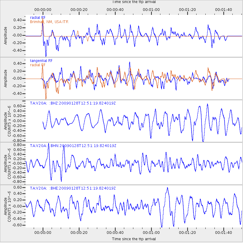
V20A Brimhall, NM, USA - Earthquake Result Viewer
*The percent match for this event was below the threshold and hence no stack was calculated.
| Earthquake location: |
Samoa Islands Region |
| Earthquake latitude/longitude: |
-17.0/-172.1 |
| Earthquake time(UTC): |
2009/01/28 (028) 12:39:42 GMT |
| Earthquake Depth: |
10 km |
| Earthquake Magnitude: |
5.6 MB, 5.3 MS, 5.5 MW |
| Earthquake Catalog/Contributor: |
WHDF/NEIC |
|
| Network: |
TA USArray Transportable Network (new EarthScope stations) |
| Station: |
V20A Brimhall, NM, USA |
| Lat/Lon: |
35.80 N/108.47 W |
| Elevation: |
1889 m |
|
| Distance: |
79.8 deg |
| Az: |
47.717 deg |
| Baz: |
240.568 deg |
| Ray Param: |
$rayparam |
*The percent match for this event was below the threshold and hence was not used in the summary stack. |
|
| Radial Match: |
60.91516 % |
| Radial Bump: |
400 |
| Transverse Match: |
66.84837 % |
| Transverse Bump: |
400 |
| SOD ConfigId: |
2658 |
| Insert Time: |
2010-03-06 00:56:40.511 +0000 |
| GWidth: |
2.5 |
| Max Bumps: |
400 |
| Tol: |
0.001 |
|
Signal To Noise
| Channel | StoN | STA | LTA |
| TA:V20A: :BHN:20090128T12:51:19.824019Z | 3.4463537 | 3.8758358E-7 | 1.1246193E-7 |
| TA:V20A: :BHE:20090128T12:51:19.824019Z | 0.85083205 | 1.3059677E-7 | 1.53493E-7 |
| TA:V20A: :BHZ:20090128T12:51:19.824019Z | 1.482413 | 2.731086E-7 | 1.8423245E-7 |
| Arrivals |
| Ps | |
| PpPs | |
| PsPs/PpSs | |


