You are here: Home > Network List > AV - Alaska Volcano Observatory Stations List
> Station SPCR Ckakachatna River, Mount Spurr, Alaska > Earthquake Result Viewer
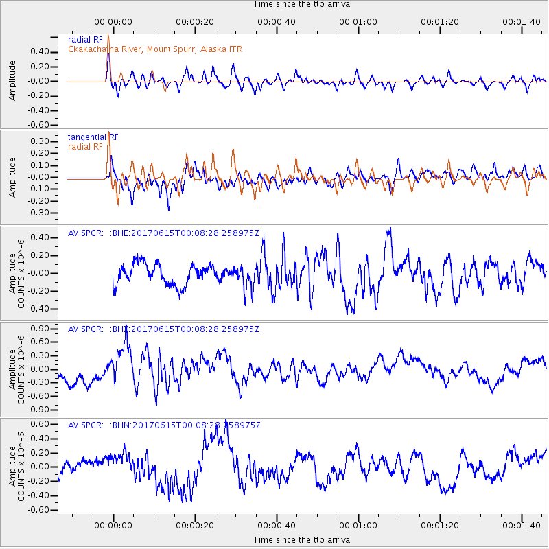
SPCR Ckakachatna River, Mount Spurr, Alaska - Earthquake Result Viewer
*The percent match for this event was below the threshold and hence no stack was calculated.
| Earthquake location: |
Near Coast Of Oaxaca, Mexico |
| Earthquake latitude/longitude: |
15.4/-97.1 |
| Earthquake time(UTC): |
2017/06/14 (165) 23:58:52 GMT |
| Earthquake Depth: |
6.9 km |
| Earthquake Magnitude: |
5.5 Mww |
| Earthquake Catalog/Contributor: |
NEIC PDE/us |
|
| Network: |
AV Alaska Volcano Observatory |
| Station: |
SPCR Ckakachatna River, Mount Spurr, Alaska |
| Lat/Lon: |
61.20 N/152.21 W |
| Elevation: |
984 m |
|
| Distance: |
60.2 deg |
| Az: |
332.747 deg |
| Baz: |
114.172 deg |
| Ray Param: |
$rayparam |
*The percent match for this event was below the threshold and hence was not used in the summary stack. |
|
| Radial Match: |
70.453964 % |
| Radial Bump: |
400 |
| Transverse Match: |
49.473446 % |
| Transverse Bump: |
400 |
| SOD ConfigId: |
13570011 |
| Insert Time: |
2019-04-28 05:13:55.747 +0000 |
| GWidth: |
2.5 |
| Max Bumps: |
400 |
| Tol: |
0.001 |
|
Signal To Noise
| Channel | StoN | STA | LTA |
| AV:SPCR: :BHZ:20170615T00:08:28.258975Z | 2.336307 | 4.688484E-7 | 2.006793E-7 |
| AV:SPCR: :BHN:20170615T00:08:28.258975Z | 0.73904073 | 1.5826956E-7 | 2.1415538E-7 |
| AV:SPCR: :BHE:20170615T00:08:28.258975Z | 1.2264171 | 1.3354328E-7 | 1.0888896E-7 |
| Arrivals |
| Ps | |
| PpPs | |
| PsPs/PpSs | |


