You are here: Home > Network List > LD - Lamont-Doherty Cooperative Seismographic Network Stations List
> Station GEDE Greenville, DE, USA > Earthquake Result Viewer
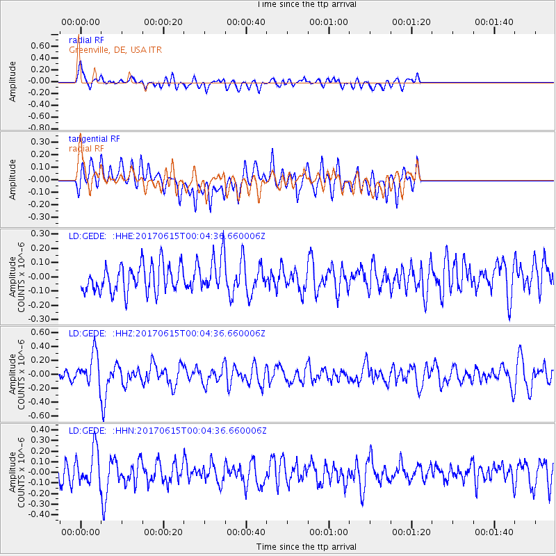
GEDE Greenville, DE, USA - Earthquake Result Viewer
*The percent match for this event was below the threshold and hence no stack was calculated.
| Earthquake location: |
Near Coast Of Oaxaca, Mexico |
| Earthquake latitude/longitude: |
15.4/-97.1 |
| Earthquake time(UTC): |
2017/06/14 (165) 23:58:52 GMT |
| Earthquake Depth: |
6.9 km |
| Earthquake Magnitude: |
5.5 Mww |
| Earthquake Catalog/Contributor: |
NEIC PDE/us |
|
| Network: |
LD Lamont-Doherty Cooperative Seismographic Network |
| Station: |
GEDE Greenville, DE, USA |
| Lat/Lon: |
39.81 N/75.64 W |
| Elevation: |
105 m |
|
| Distance: |
30.7 deg |
| Az: |
33.437 deg |
| Baz: |
223.642 deg |
| Ray Param: |
$rayparam |
*The percent match for this event was below the threshold and hence was not used in the summary stack. |
|
| Radial Match: |
59.35224 % |
| Radial Bump: |
400 |
| Transverse Match: |
61.415398 % |
| Transverse Bump: |
400 |
| SOD ConfigId: |
13570011 |
| Insert Time: |
2019-04-28 05:16:21.737 +0000 |
| GWidth: |
2.5 |
| Max Bumps: |
400 |
| Tol: |
0.001 |
|
Signal To Noise
| Channel | StoN | STA | LTA |
| LD:GEDE: :HHZ:20170615T00:04:36.660006Z | 2.7312198 | 2.4271193E-7 | 8.886577E-8 |
| LD:GEDE: :HHN:20170615T00:04:36.660006Z | 2.034134 | 1.7039544E-7 | 8.376805E-8 |
| LD:GEDE: :HHE:20170615T00:04:36.660006Z | 1.3900979 | 1.315324E-7 | 9.4620965E-8 |
| Arrivals |
| Ps | |
| PpPs | |
| PsPs/PpSs | |


