You are here: Home > Network List > TA - USArray Transportable Network (new EarthScope stations) Stations List
> Station G21K Allakaket, AK, USA > Earthquake Result Viewer
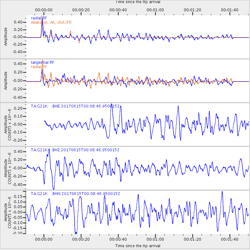
G21K Allakaket, AK, USA - Earthquake Result Viewer
*The percent match for this event was below the threshold and hence no stack was calculated.
| Earthquake location: |
Near Coast Of Oaxaca, Mexico |
| Earthquake latitude/longitude: |
15.4/-97.1 |
| Earthquake time(UTC): |
2017/06/14 (165) 23:58:52 GMT |
| Earthquake Depth: |
6.9 km |
| Earthquake Magnitude: |
5.5 Mww |
| Earthquake Catalog/Contributor: |
NEIC PDE/us |
|
| Network: |
TA USArray Transportable Network (new EarthScope stations) |
| Station: |
G21K Allakaket, AK, USA |
| Lat/Lon: |
66.52 N/153.51 W |
| Elevation: |
446 m |
|
| Distance: |
62.9 deg |
| Az: |
337.981 deg |
| Baz: |
115.503 deg |
| Ray Param: |
$rayparam |
*The percent match for this event was below the threshold and hence was not used in the summary stack. |
|
| Radial Match: |
74.616295 % |
| Radial Bump: |
400 |
| Transverse Match: |
59.16025 % |
| Transverse Bump: |
400 |
| SOD ConfigId: |
13570011 |
| Insert Time: |
2019-04-28 05:18:15.056 +0000 |
| GWidth: |
2.5 |
| Max Bumps: |
400 |
| Tol: |
0.001 |
|
Signal To Noise
| Channel | StoN | STA | LTA |
| TA:G21K: :BHZ:20170615T00:08:46.950015Z | 4.033582 | 2.6777778E-7 | 6.6387095E-8 |
| TA:G21K: :BHN:20170615T00:08:46.950015Z | 1.7459726 | 7.821554E-8 | 4.479769E-8 |
| TA:G21K: :BHE:20170615T00:08:46.950015Z | 3.0881534 | 8.972362E-8 | 2.9054133E-8 |
| Arrivals |
| Ps | |
| PpPs | |
| PsPs/PpSs | |


