You are here: Home > Network List > TA - USArray Transportable Network (new EarthScope stations) Stations List
> Station J20K Nowitna River, AK, USA > Earthquake Result Viewer
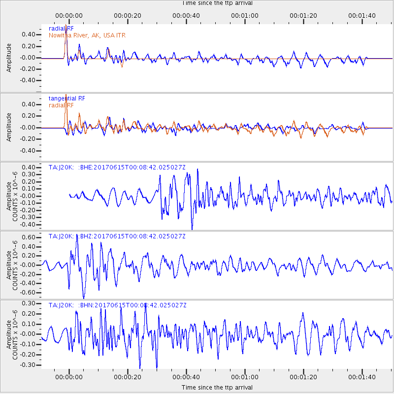
J20K Nowitna River, AK, USA - Earthquake Result Viewer
*The percent match for this event was below the threshold and hence no stack was calculated.
| Earthquake location: |
Near Coast Of Oaxaca, Mexico |
| Earthquake latitude/longitude: |
15.4/-97.1 |
| Earthquake time(UTC): |
2017/06/14 (165) 23:58:52 GMT |
| Earthquake Depth: |
6.9 km |
| Earthquake Magnitude: |
5.5 Mww |
| Earthquake Catalog/Contributor: |
NEIC PDE/us |
|
| Network: |
TA USArray Transportable Network (new EarthScope stations) |
| Station: |
J20K Nowitna River, AK, USA |
| Lat/Lon: |
64.18 N/154.15 W |
| Elevation: |
314 m |
|
| Distance: |
62.2 deg |
| Az: |
335.449 deg |
| Baz: |
113.755 deg |
| Ray Param: |
$rayparam |
*The percent match for this event was below the threshold and hence was not used in the summary stack. |
|
| Radial Match: |
68.672585 % |
| Radial Bump: |
400 |
| Transverse Match: |
73.7659 % |
| Transverse Bump: |
400 |
| SOD ConfigId: |
13570011 |
| Insert Time: |
2019-04-28 05:18:34.122 +0000 |
| GWidth: |
2.5 |
| Max Bumps: |
400 |
| Tol: |
0.001 |
|
Signal To Noise
| Channel | StoN | STA | LTA |
| TA:J20K: :BHZ:20170615T00:08:42.025027Z | 5.374528 | 3.2497817E-7 | 6.046636E-8 |
| TA:J20K: :BHN:20170615T00:08:42.025027Z | 3.1900613 | 1.1761796E-7 | 3.6870123E-8 |
| TA:J20K: :BHE:20170615T00:08:42.025027Z | 3.0456982 | 1.8954078E-7 | 6.2232296E-8 |
| Arrivals |
| Ps | |
| PpPs | |
| PsPs/PpSs | |


