You are here: Home > Network List > AV - Alaska Volcano Observatory Stations List
> Station MAPS Pakushin Southeast, Makushin Volcano, Alaska > Earthquake Result Viewer
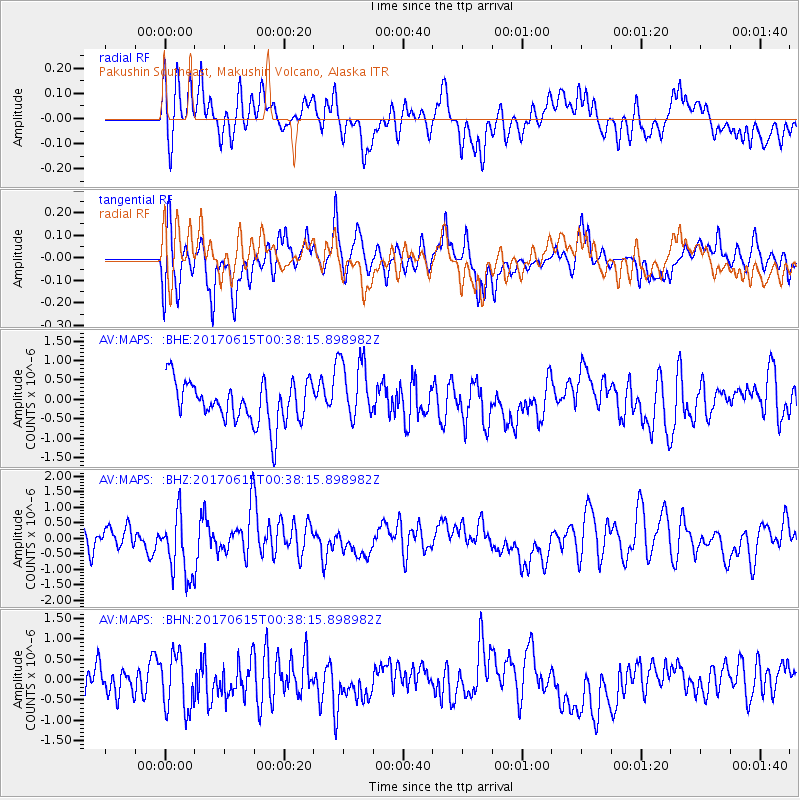
MAPS Pakushin Southeast, Makushin Volcano, Alaska - Earthquake Result Viewer
*The percent match for this event was below the threshold and hence no stack was calculated.
| Earthquake location: |
Kermadec Islands, New Zealand |
| Earthquake latitude/longitude: |
-30.6/-178.0 |
| Earthquake time(UTC): |
2017/06/15 (166) 00:26:16 GMT |
| Earthquake Depth: |
24 km |
| Earthquake Magnitude: |
5.9 Mww |
| Earthquake Catalog/Contributor: |
NEIC PDE/us |
|
| Network: |
AV Alaska Volcano Observatory |
| Station: |
MAPS Pakushin Southeast, Makushin Volcano, Alaska |
| Lat/Lon: |
53.81 N/166.94 W |
| Elevation: |
333 m |
|
| Distance: |
84.6 deg |
| Az: |
6.561 deg |
| Baz: |
189.565 deg |
| Ray Param: |
$rayparam |
*The percent match for this event was below the threshold and hence was not used in the summary stack. |
|
| Radial Match: |
58.890884 % |
| Radial Bump: |
400 |
| Transverse Match: |
57.40964 % |
| Transverse Bump: |
400 |
| SOD ConfigId: |
13570011 |
| Insert Time: |
2019-04-28 05:21:32.680 +0000 |
| GWidth: |
2.5 |
| Max Bumps: |
400 |
| Tol: |
0.001 |
|
Signal To Noise
| Channel | StoN | STA | LTA |
| AV:MAPS: :BHZ:20170615T00:38:15.898982Z | 2.7622502 | 1.0600107E-6 | 3.8374898E-7 |
| AV:MAPS: :BHN:20170615T00:38:15.898982Z | 1.9281665 | 6.858336E-7 | 3.5569212E-7 |
| AV:MAPS: :BHE:20170615T00:38:15.898982Z | 1.5549374 | 8.286044E-7 | 5.328861E-7 |
| Arrivals |
| Ps | |
| PpPs | |
| PsPs/PpSs | |


