You are here: Home > Network List > TA - USArray Transportable Network (new EarthScope stations) Stations List
> Station T29A Hugoton, KS, USA > Earthquake Result Viewer
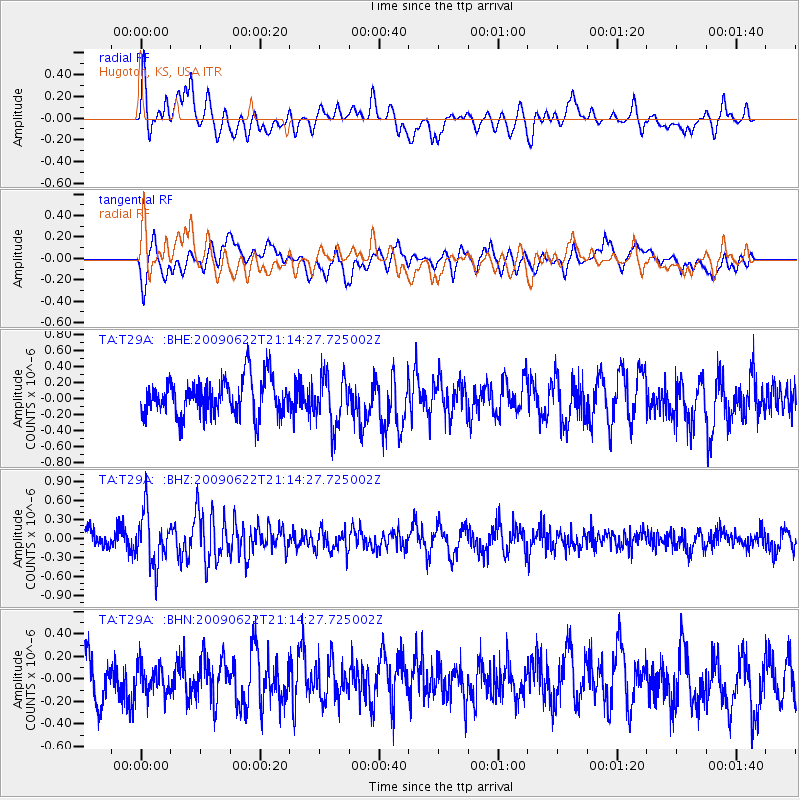
T29A Hugoton, KS, USA - Earthquake Result Viewer
*The percent match for this event was below the threshold and hence no stack was calculated.
| Earthquake location: |
Andreanof Islands, Aleutian Is. |
| Earthquake latitude/longitude: |
51.3/-178.2 |
| Earthquake time(UTC): |
2009/06/22 (173) 21:05:33 GMT |
| Earthquake Depth: |
29 km |
| Earthquake Magnitude: |
5.5 MB, 5.0 MS, 5.4 MW, 5.4 MW |
| Earthquake Catalog/Contributor: |
WHDF/NEIC |
|
| Network: |
TA USArray Transportable Network (new EarthScope stations) |
| Station: |
T29A Hugoton, KS, USA |
| Lat/Lon: |
37.16 N/101.29 W |
| Elevation: |
936 m |
|
| Distance: |
54.4 deg |
| Az: |
73.083 deg |
| Baz: |
311.319 deg |
| Ray Param: |
$rayparam |
*The percent match for this event was below the threshold and hence was not used in the summary stack. |
|
| Radial Match: |
56.790497 % |
| Radial Bump: |
400 |
| Transverse Match: |
59.935806 % |
| Transverse Bump: |
400 |
| SOD ConfigId: |
2648 |
| Insert Time: |
2010-03-06 00:59:57.174 +0000 |
| GWidth: |
2.5 |
| Max Bumps: |
400 |
| Tol: |
0.001 |
|
Signal To Noise
| Channel | StoN | STA | LTA |
| TA:T29A: :BHZ:20090622T21:14:27.725002Z | 2.5152776 | 4.077872E-7 | 1.6212412E-7 |
| TA:T29A: :BHN:20090622T21:14:27.725002Z | 0.6508484 | 1.3590758E-7 | 2.0881603E-7 |
| TA:T29A: :BHE:20090622T21:14:27.725002Z | 1.3500402 | 3.1319405E-7 | 2.3198868E-7 |
| Arrivals |
| Ps | |
| PpPs | |
| PsPs/PpSs | |


