You are here: Home > Network List > GM - US Geological Survey Networks Stations List
> Station IWM01 Jericho 2M Well Monitoring Station > Earthquake Result Viewer
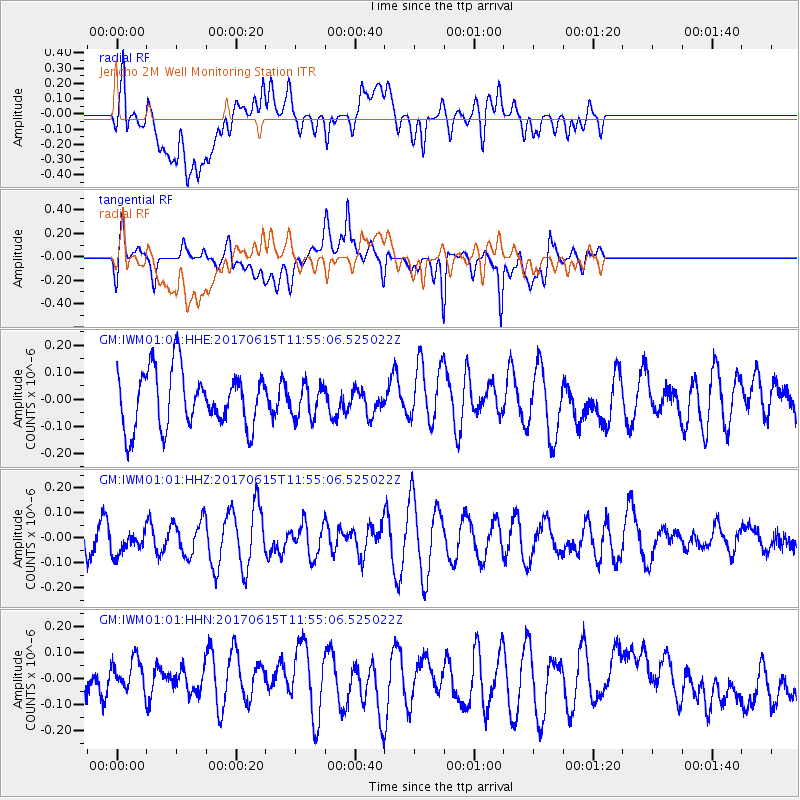
IWM01 Jericho 2M Well Monitoring Station - Earthquake Result Viewer
*The percent match for this event was below the threshold and hence no stack was calculated.
| Earthquake location: |
Southern East Pacific Rise |
| Earthquake latitude/longitude: |
-55.4/-124.8 |
| Earthquake time(UTC): |
2017/06/15 (166) 11:42:15 GMT |
| Earthquake Depth: |
10 km |
| Earthquake Magnitude: |
5.8 Mww |
| Earthquake Catalog/Contributor: |
NEIC PDE/us |
|
| Network: |
GM US Geological Survey Networks |
| Station: |
IWM01 Jericho 2M Well Monitoring Station |
| Lat/Lon: |
36.73 N/96.53 W |
| Elevation: |
328 m |
|
| Distance: |
94.9 deg |
| Az: |
22.443 deg |
| Baz: |
195.722 deg |
| Ray Param: |
$rayparam |
*The percent match for this event was below the threshold and hence was not used in the summary stack. |
|
| Radial Match: |
51.544563 % |
| Radial Bump: |
400 |
| Transverse Match: |
60.51976 % |
| Transverse Bump: |
400 |
| SOD ConfigId: |
13570011 |
| Insert Time: |
2019-04-28 05:28:16.482 +0000 |
| GWidth: |
2.5 |
| Max Bumps: |
400 |
| Tol: |
0.001 |
|
Signal To Noise
| Channel | StoN | STA | LTA |
| GM:IWM01:01:HHZ:20170615T11:55:06.525022Z | 0.48188838 | 4.6247E-8 | 9.597036E-8 |
| GM:IWM01:01:HHN:20170615T11:55:06.525022Z | 0.9515622 | 8.970668E-8 | 9.4273055E-8 |
| GM:IWM01:01:HHE:20170615T11:55:06.525022Z | 0.56930023 | 5.9890624E-8 | 1.0520042E-7 |
| Arrivals |
| Ps | |
| PpPs | |
| PsPs/PpSs | |


