You are here: Home > Network List > II - Global Seismograph Network (GSN - IRIS/IDA) Stations List
> Station WRAB Tennant Creek, NT, Australia > Earthquake Result Viewer
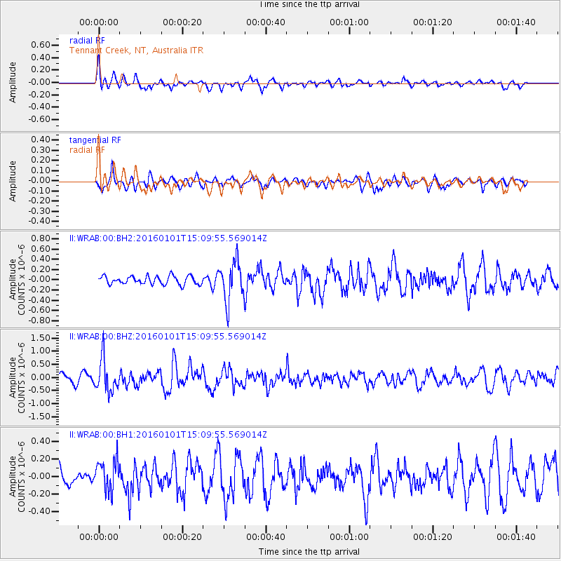
WRAB Tennant Creek, NT, Australia - Earthquake Result Viewer
*The percent match for this event was below the threshold and hence no stack was calculated.
| Earthquake location: |
Kermadec Islands, New Zealand |
| Earthquake latitude/longitude: |
-29.1/-177.1 |
| Earthquake time(UTC): |
2016/01/01 (001) 15:02:15 GMT |
| Earthquake Depth: |
38 km |
| Earthquake Magnitude: |
5.8 MWB |
| Earthquake Catalog/Contributor: |
NEIC PDE/NEIC COMCAT |
|
| Network: |
II Global Seismograph Network (GSN - IRIS/IDA) |
| Station: |
WRAB Tennant Creek, NT, Australia |
| Lat/Lon: |
19.93 S/134.36 E |
| Elevation: |
366 m |
|
| Distance: |
44.8 deg |
| Az: |
270.394 deg |
| Baz: |
111.551 deg |
| Ray Param: |
$rayparam |
*The percent match for this event was below the threshold and hence was not used in the summary stack. |
|
| Radial Match: |
74.07691 % |
| Radial Bump: |
395 |
| Transverse Match: |
63.475708 % |
| Transverse Bump: |
400 |
| SOD ConfigId: |
1379111 |
| Insert Time: |
2016-01-15 15:37:28.776 +0000 |
| GWidth: |
2.5 |
| Max Bumps: |
400 |
| Tol: |
0.001 |
|
Signal To Noise
| Channel | StoN | STA | LTA |
| II:WRAB:00:BHZ:20160101T15:09:55.569014Z | 3.1608226 | 6.369352E-7 | 2.0150932E-7 |
| II:WRAB:00:BH1:20160101T15:09:55.569014Z | 1.6883343 | 1.7277549E-7 | 1.0233488E-7 |
| II:WRAB:00:BH2:20160101T15:09:55.569014Z | 4.9185934 | 3.964617E-7 | 8.060469E-8 |
| Arrivals |
| Ps | |
| PpPs | |
| PsPs/PpSs | |


