You are here: Home > Network List > TA - USArray Transportable Network (new EarthScope stations) Stations List
> Station MDND Maddock, ND, USA > Earthquake Result Viewer
MDND Maddock, ND, USA - Earthquake Result Viewer
*The percent match for this event was below the threshold and hence no stack was calculated.
| Earthquake location: |
Near Coast Of Nicaragua |
| Earthquake latitude/longitude: |
11.3/-86.7 |
| Earthquake time(UTC): |
2017/06/17 (168) 13:47:38 GMT |
| Earthquake Depth: |
28 km |
| Earthquake Magnitude: |
5.4 Mww |
| Earthquake Catalog/Contributor: |
NEIC PDE/us |
|
| Network: |
TA USArray Transportable Network (new EarthScope stations) |
| Station: |
MDND Maddock, ND, USA |
| Lat/Lon: |
47.85 N/99.60 W |
| Elevation: |
479 m |
|
| Distance: |
38.0 deg |
| Az: |
345.869 deg |
| Baz: |
159.173 deg |
| Ray Param: |
$rayparam |
*The percent match for this event was below the threshold and hence was not used in the summary stack. |
|
| Radial Match: |
71.06607 % |
| Radial Bump: |
400 |
| Transverse Match: |
67.9305 % |
| Transverse Bump: |
400 |
| SOD ConfigId: |
13570011 |
| Insert Time: |
2019-04-28 05:40:03.370 +0000 |
| GWidth: |
2.5 |
| Max Bumps: |
400 |
| Tol: |
0.001 |
|
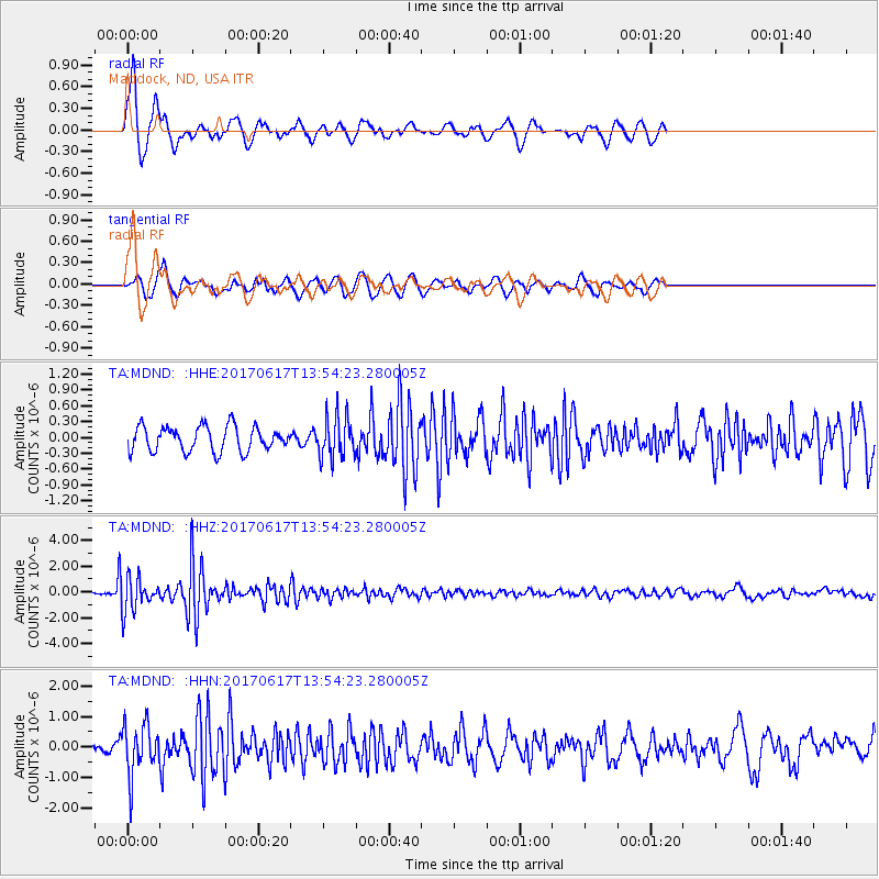
Signal To Noise
| Channel | StoN | STA | LTA |
| TA:MDND: :HHZ:20170617T13:54:23.280005Z | 18.304228 | 1.2620654E-6 | 6.894939E-8 |
| TA:MDND: :HHN:20170617T13:54:23.280005Z | 3.1935248 | 8.5951456E-7 | 2.691429E-7 |
| TA:MDND: :HHE:20170617T13:54:23.280005Z | 1.6691089 | 3.9379765E-7 | 2.3593286E-7 |
| Arrivals |
| Ps | |
| PpPs | |
| PsPs/PpSs | |


