You are here: Home > Network List > TA - USArray Transportable Network (new EarthScope stations) Stations List
> Station R17K Ugashik Creek, AK, USA > Earthquake Result Viewer
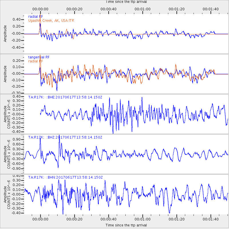
R17K Ugashik Creek, AK, USA - Earthquake Result Viewer
*The percent match for this event was below the threshold and hence no stack was calculated.
| Earthquake location: |
Near Coast Of Nicaragua |
| Earthquake latitude/longitude: |
11.3/-86.7 |
| Earthquake time(UTC): |
2017/06/17 (168) 13:47:38 GMT |
| Earthquake Depth: |
28 km |
| Earthquake Magnitude: |
5.4 Mww |
| Earthquake Catalog/Contributor: |
NEIC PDE/us |
|
| Network: |
TA USArray Transportable Network (new EarthScope stations) |
| Station: |
R17K Ugashik Creek, AK, USA |
| Lat/Lon: |
57.64 N/156.39 W |
| Elevation: |
273 m |
|
| Distance: |
69.7 deg |
| Az: |
327.468 deg |
| Baz: |
101.226 deg |
| Ray Param: |
$rayparam |
*The percent match for this event was below the threshold and hence was not used in the summary stack. |
|
| Radial Match: |
63.40655 % |
| Radial Bump: |
400 |
| Transverse Match: |
64.49249 % |
| Transverse Bump: |
400 |
| SOD ConfigId: |
13570011 |
| Insert Time: |
2019-04-28 05:40:27.920 +0000 |
| GWidth: |
2.5 |
| Max Bumps: |
400 |
| Tol: |
0.001 |
|
Signal To Noise
| Channel | StoN | STA | LTA |
| TA:R17K: :BHZ:20170617T13:58:14.150Z | 3.8296397 | 3.802108E-7 | 9.928108E-8 |
| TA:R17K: :BHN:20170617T13:58:14.150Z | 1.442123 | 1.04649885E-7 | 7.256654E-8 |
| TA:R17K: :BHE:20170617T13:58:14.150Z | 1.7966765 | 1.2682769E-7 | 7.059016E-8 |
| Arrivals |
| Ps | |
| PpPs | |
| PsPs/PpSs | |


