You are here: Home > Network List > UW - Pacific Northwest Regional Seismic Network Stations List
> Station UMAT Pilot Rock, OR, USA > Earthquake Result Viewer
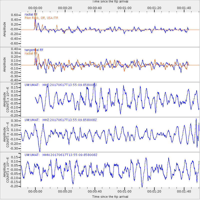
UMAT Pilot Rock, OR, USA - Earthquake Result Viewer
*The percent match for this event was below the threshold and hence no stack was calculated.
| Earthquake location: |
Near Coast Of Nicaragua |
| Earthquake latitude/longitude: |
11.3/-86.7 |
| Earthquake time(UTC): |
2017/06/17 (168) 13:47:38 GMT |
| Earthquake Depth: |
28 km |
| Earthquake Magnitude: |
5.4 Mww |
| Earthquake Catalog/Contributor: |
NEIC PDE/us |
|
| Network: |
UW Pacific Northwest Regional Seismic Network |
| Station: |
UMAT Pilot Rock, OR, USA |
| Lat/Lon: |
45.29 N/118.96 W |
| Elevation: |
1318 m |
|
| Distance: |
43.7 deg |
| Az: |
326.939 deg |
| Baz: |
130.703 deg |
| Ray Param: |
$rayparam |
*The percent match for this event was below the threshold and hence was not used in the summary stack. |
|
| Radial Match: |
67.15788 % |
| Radial Bump: |
400 |
| Transverse Match: |
67.8674 % |
| Transverse Bump: |
386 |
| SOD ConfigId: |
13570011 |
| Insert Time: |
2019-04-28 05:41:07.078 +0000 |
| GWidth: |
2.5 |
| Max Bumps: |
400 |
| Tol: |
0.001 |
|
Signal To Noise
| Channel | StoN | STA | LTA |
| UW:UMAT: :HHZ:20170617T13:55:09.858008Z | 2.615102 | 1.8156227E-7 | 6.9428374E-8 |
| UW:UMAT: :HHN:20170617T13:55:09.858008Z | 1.0583186 | 6.843253E-8 | 6.466155E-8 |
| UW:UMAT: :HHE:20170617T13:55:09.858008Z | 1.0464463 | 7.107564E-8 | 6.7920965E-8 |
| Arrivals |
| Ps | |
| PpPs | |
| PsPs/PpSs | |


