You are here: Home > Network List > UW - Pacific Northwest Regional Seismic Network Stations List
> Station MRBL Marblemount, WA, USA > Earthquake Result Viewer
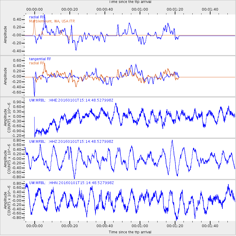
MRBL Marblemount, WA, USA - Earthquake Result Viewer
*The percent match for this event was below the threshold and hence no stack was calculated.
| Earthquake location: |
Kermadec Islands, New Zealand |
| Earthquake latitude/longitude: |
-29.1/-177.1 |
| Earthquake time(UTC): |
2016/01/01 (001) 15:02:15 GMT |
| Earthquake Depth: |
38 km |
| Earthquake Magnitude: |
5.8 MWB |
| Earthquake Catalog/Contributor: |
NEIC PDE/NEIC COMCAT |
|
| Network: |
UW Pacific Northwest Regional Seismic Network |
| Station: |
MRBL Marblemount, WA, USA |
| Lat/Lon: |
48.52 N/121.48 W |
| Elevation: |
75 m |
|
| Distance: |
91.9 deg |
| Az: |
33.293 deg |
| Baz: |
226.257 deg |
| Ray Param: |
$rayparam |
*The percent match for this event was below the threshold and hence was not used in the summary stack. |
|
| Radial Match: |
33.16384 % |
| Radial Bump: |
400 |
| Transverse Match: |
28.13634 % |
| Transverse Bump: |
400 |
| SOD ConfigId: |
1379111 |
| Insert Time: |
2016-01-15 16:00:57.862 +0000 |
| GWidth: |
2.5 |
| Max Bumps: |
400 |
| Tol: |
0.001 |
|
Signal To Noise
| Channel | StoN | STA | LTA |
| UW:MRBL: :HHZ:20160101T15:14:48.527998Z | 0.6523454 | 2.4422712E-7 | 3.7438315E-7 |
| UW:MRBL: :HHN:20160101T15:14:48.527998Z | 0.9887445 | 4.498808E-7 | 4.5500207E-7 |
| UW:MRBL: :HHE:20160101T15:14:48.527998Z | 1.5487546 | 6.3690857E-7 | 4.1123917E-7 |
| Arrivals |
| Ps | |
| PpPs | |
| PsPs/PpSs | |


