You are here: Home > Network List > AV - Alaska Volcano Observatory Stations List
> Station AMKA Regional Station, Amchitka Island, Alaska > Earthquake Result Viewer
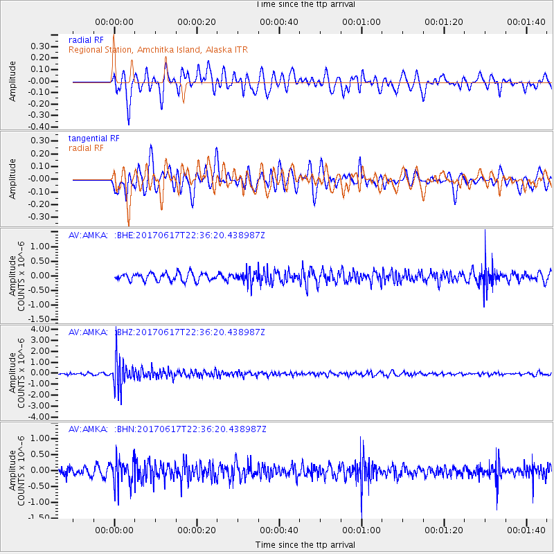
AMKA Regional Station, Amchitka Island, Alaska - Earthquake Result Viewer
*The percent match for this event was below the threshold and hence no stack was calculated.
| Earthquake location: |
South Of Fiji Islands |
| Earthquake latitude/longitude: |
-24.1/179.6 |
| Earthquake time(UTC): |
2017/06/17 (168) 22:26:02 GMT |
| Earthquake Depth: |
518 km |
| Earthquake Magnitude: |
6.1 Mww |
| Earthquake Catalog/Contributor: |
NEIC PDE/us |
|
| Network: |
AV Alaska Volcano Observatory |
| Station: |
AMKA Regional Station, Amchitka Island, Alaska |
| Lat/Lon: |
51.38 N/179.30 E |
| Elevation: |
116 m |
|
| Distance: |
75.2 deg |
| Az: |
359.813 deg |
| Baz: |
179.727 deg |
| Ray Param: |
$rayparam |
*The percent match for this event was below the threshold and hence was not used in the summary stack. |
|
| Radial Match: |
66.12233 % |
| Radial Bump: |
400 |
| Transverse Match: |
57.135696 % |
| Transverse Bump: |
400 |
| SOD ConfigId: |
13570011 |
| Insert Time: |
2019-04-28 05:43:11.814 +0000 |
| GWidth: |
2.5 |
| Max Bumps: |
400 |
| Tol: |
0.001 |
|
Signal To Noise
| Channel | StoN | STA | LTA |
| AV:AMKA: :BHZ:20170617T22:36:20.438987Z | 18.357689 | 1.245855E-6 | 6.7865564E-8 |
| AV:AMKA: :BHN:20170617T22:36:20.438987Z | 4.328291 | 3.906509E-7 | 9.0255234E-8 |
| AV:AMKA: :BHE:20170617T22:36:20.438987Z | 1.5997891 | 2.0851533E-7 | 1.3033926E-7 |
| Arrivals |
| Ps | |
| PpPs | |
| PsPs/PpSs | |


