You are here: Home > Network List > AZ - ANZA Regional Network Stations List
> Station SMER AZ.SMER > Earthquake Result Viewer
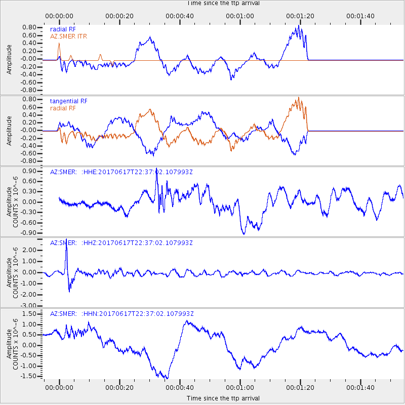
SMER AZ.SMER - Earthquake Result Viewer
*The percent match for this event was below the threshold and hence no stack was calculated.
| Earthquake location: |
South Of Fiji Islands |
| Earthquake latitude/longitude: |
-24.1/179.6 |
| Earthquake time(UTC): |
2017/06/17 (168) 22:26:02 GMT |
| Earthquake Depth: |
518 km |
| Earthquake Magnitude: |
6.1 Mww |
| Earthquake Catalog/Contributor: |
NEIC PDE/us |
|
| Network: |
AZ ANZA Regional Network |
| Station: |
SMER AZ.SMER |
| Lat/Lon: |
33.46 N/117.17 W |
| Elevation: |
355 m |
|
| Distance: |
83.0 deg |
| Az: |
48.762 deg |
| Baz: |
235.284 deg |
| Ray Param: |
$rayparam |
*The percent match for this event was below the threshold and hence was not used in the summary stack. |
|
| Radial Match: |
25.023542 % |
| Radial Bump: |
400 |
| Transverse Match: |
29.533457 % |
| Transverse Bump: |
372 |
| SOD ConfigId: |
13570011 |
| Insert Time: |
2019-04-28 05:43:43.527 +0000 |
| GWidth: |
2.5 |
| Max Bumps: |
400 |
| Tol: |
0.001 |
|
Signal To Noise
| Channel | StoN | STA | LTA |
| AZ:SMER: :HHZ:20170617T22:37:02.107993Z | 16.896011 | 9.2831937E-7 | 5.4943104E-8 |
| AZ:SMER: :HHN:20170617T22:37:02.107993Z | 1.056592 | 7.921168E-7 | 7.4969034E-7 |
| AZ:SMER: :HHE:20170617T22:37:02.107993Z | 3.838867 | 3.9966665E-7 | 1.04110576E-7 |
| Arrivals |
| Ps | |
| PpPs | |
| PsPs/PpSs | |


