You are here: Home > Network List > CI - Caltech Regional Seismic Network Stations List
> Station DGR Domenigoni Reservoir, California, USA > Earthquake Result Viewer
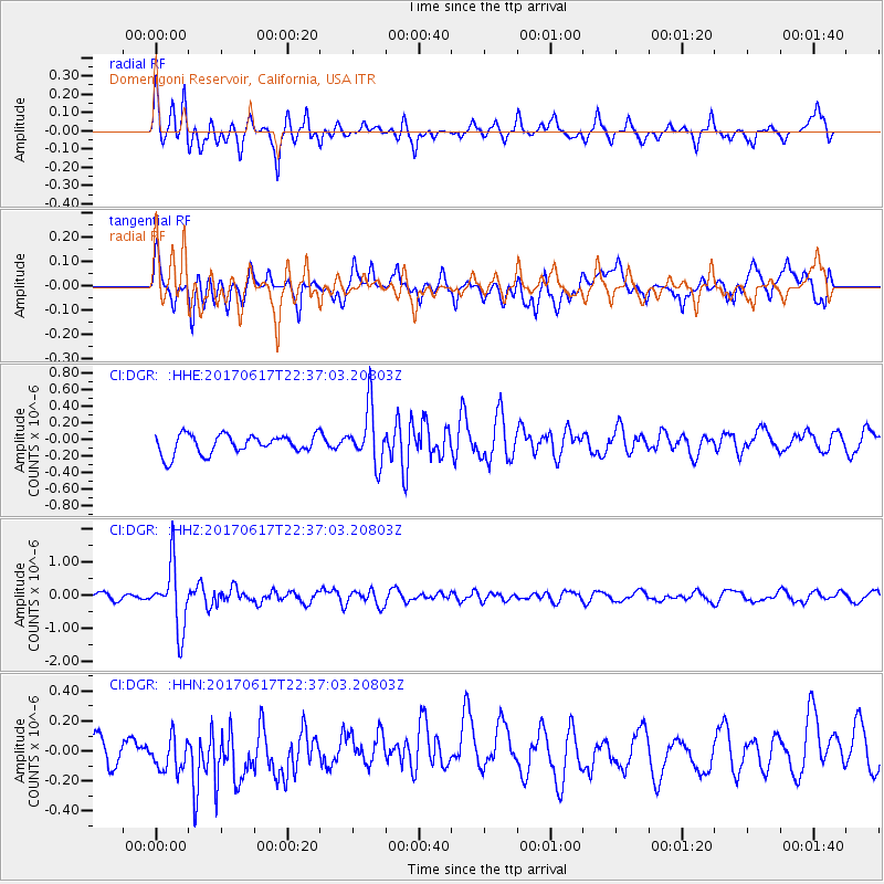
DGR Domenigoni Reservoir, California, USA - Earthquake Result Viewer
*The percent match for this event was below the threshold and hence no stack was calculated.
| Earthquake location: |
South Of Fiji Islands |
| Earthquake latitude/longitude: |
-24.1/179.6 |
| Earthquake time(UTC): |
2017/06/17 (168) 22:26:02 GMT |
| Earthquake Depth: |
518 km |
| Earthquake Magnitude: |
6.1 Mww |
| Earthquake Catalog/Contributor: |
NEIC PDE/us |
|
| Network: |
CI Caltech Regional Seismic Network |
| Station: |
DGR Domenigoni Reservoir, California, USA |
| Lat/Lon: |
33.65 N/117.01 W |
| Elevation: |
609 m |
|
| Distance: |
83.3 deg |
| Az: |
48.681 deg |
| Baz: |
235.363 deg |
| Ray Param: |
$rayparam |
*The percent match for this event was below the threshold and hence was not used in the summary stack. |
|
| Radial Match: |
72.00394 % |
| Radial Bump: |
379 |
| Transverse Match: |
53.994427 % |
| Transverse Bump: |
400 |
| SOD ConfigId: |
13570011 |
| Insert Time: |
2019-04-28 05:44:45.364 +0000 |
| GWidth: |
2.5 |
| Max Bumps: |
400 |
| Tol: |
0.001 |
|
Signal To Noise
| Channel | StoN | STA | LTA |
| CI:DGR: :HHZ:20170617T22:37:03.20803Z | 7.1571355 | 9.4690387E-7 | 1.3230208E-7 |
| CI:DGR: :HHN:20170617T22:37:03.20803Z | 1.3947839 | 1.3433484E-7 | 9.63123E-8 |
| CI:DGR: :HHE:20170617T22:37:03.20803Z | 2.9284866 | 3.3797386E-7 | 1.1540906E-7 |
| Arrivals |
| Ps | |
| PpPs | |
| PsPs/PpSs | |


