You are here: Home > Network List > CI - Caltech Regional Seismic Network Stations List
> Station SMM Simmler, CA, USA > Earthquake Result Viewer
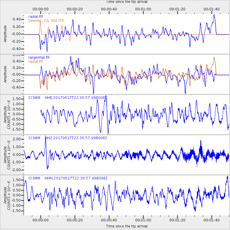
SMM Simmler, CA, USA - Earthquake Result Viewer
*The percent match for this event was below the threshold and hence no stack was calculated.
| Earthquake location: |
South Of Fiji Islands |
| Earthquake latitude/longitude: |
-24.1/179.6 |
| Earthquake time(UTC): |
2017/06/17 (168) 22:26:02 GMT |
| Earthquake Depth: |
518 km |
| Earthquake Magnitude: |
6.1 Mww |
| Earthquake Catalog/Contributor: |
NEIC PDE/us |
|
| Network: |
CI Caltech Regional Seismic Network |
| Station: |
SMM Simmler, CA, USA |
| Lat/Lon: |
35.31 N/120.00 W |
| Elevation: |
599 m |
|
| Distance: |
82.2 deg |
| Az: |
45.872 deg |
| Baz: |
233.325 deg |
| Ray Param: |
$rayparam |
*The percent match for this event was below the threshold and hence was not used in the summary stack. |
|
| Radial Match: |
45.682846 % |
| Radial Bump: |
400 |
| Transverse Match: |
57.6207 % |
| Transverse Bump: |
400 |
| SOD ConfigId: |
13570011 |
| Insert Time: |
2019-04-28 05:45:10.510 +0000 |
| GWidth: |
2.5 |
| Max Bumps: |
400 |
| Tol: |
0.001 |
|
Signal To Noise
| Channel | StoN | STA | LTA |
| CI:SMM: :HHZ:20170617T22:36:57.998008Z | 3.2230477 | 9.652504E-7 | 2.9948373E-7 |
| CI:SMM: :HHN:20170617T22:36:57.998008Z | 0.5658331 | 3.6489706E-7 | 6.4488466E-7 |
| CI:SMM: :HHE:20170617T22:36:57.998008Z | 1.5557582 | 7.207903E-7 | 4.6330481E-7 |
| Arrivals |
| Ps | |
| PpPs | |
| PsPs/PpSs | |


