E07A Sunnyside, WA, USA - Earthquake Result Viewer
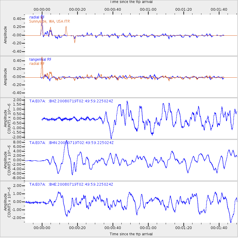
Earthquake location: Off East Coast Of Honshu, Japan
Earthquake latitude/longitude: 37.6/142.2
Earthquake time(UTC): 2008/07/19 (201) 02:39:28 GMT
Earthquake Depth: 22 km
Earthquake Magnitude: 6.2 MB, 7.0 MS, 7.0 MW, 6.9 MW
Earthquake Catalog/Contributor: WHDF/NEIC
Network: TA USArray Transportable Network (new EarthScope stations)
Station: E07A Sunnyside, WA, USA
Lat/Lon: 46.56 N/119.85 W
Elevation: 561 m
Distance: 68.7 deg
Az: 47.194 deg
Baz: 302.328 deg
Ray Param: 0.05612084
Estimated Moho Depth: 27.5 km
Estimated Crust Vp/Vs: 2.00
Assumed Crust Vp: 6.419 km/s
Estimated Crust Vs: 3.206 km/s
Estimated Crust Poisson's Ratio: 0.33
Radial Match: 89.74459 %
Radial Bump: 355
Transverse Match: 77.91202 %
Transverse Bump: 400
SOD ConfigId: 2504
Insert Time: 2010-03-06 01:04:41.312 +0000
GWidth: 2.5
Max Bumps: 400
Tol: 0.001

Signal To Noise

ChannelStoNSTALTA
TA:E07A: :BHN:20080719T02:49:59.225024Z7.76110275.9199925E-77.627773E-8
TA:E07A: :BHE:20080719T02:49:59.225024Z2.32040361.2883015E-75.552058E-8
TA:E07A: :BHZ:20080719T02:49:59.225024Z2.00020341.7495013E-78.746617E-8
Arrivals
Ps4.4 SECOND
PpPs12 SECOND
PsPs/PpSs17 SECOND