You are here: Home > Network List > TA - USArray Transportable Network (new EarthScope stations) Stations List
> Station M16K Timber Creek, AK, USA > Earthquake Result Viewer
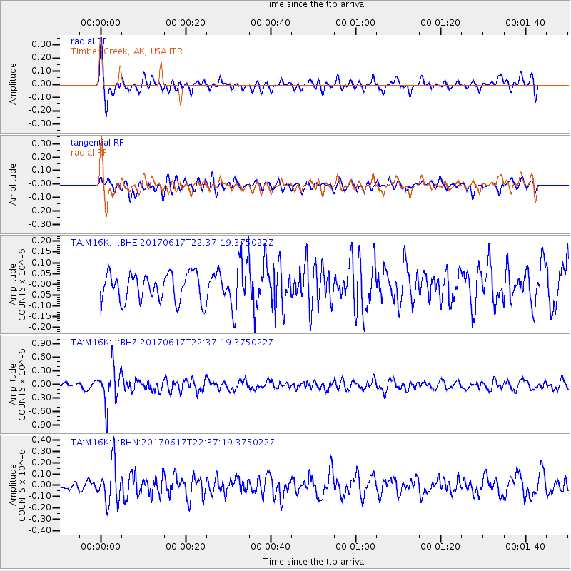
M16K Timber Creek, AK, USA - Earthquake Result Viewer
*The percent match for this event was below the threshold and hence no stack was calculated.
| Earthquake location: |
South Of Fiji Islands |
| Earthquake latitude/longitude: |
-24.1/179.6 |
| Earthquake time(UTC): |
2017/06/17 (168) 22:26:02 GMT |
| Earthquake Depth: |
518 km |
| Earthquake Magnitude: |
6.1 Mww |
| Earthquake Catalog/Contributor: |
NEIC PDE/us |
|
| Network: |
TA USArray Transportable Network (new EarthScope stations) |
| Station: |
M16K Timber Creek, AK, USA |
| Lat/Lon: |
61.02 N/158.96 W |
| Elevation: |
394 m |
|
| Distance: |
86.6 deg |
| Az: |
10.276 deg |
| Baz: |
199.558 deg |
| Ray Param: |
$rayparam |
*The percent match for this event was below the threshold and hence was not used in the summary stack. |
|
| Radial Match: |
57.915466 % |
| Radial Bump: |
400 |
| Transverse Match: |
36.07254 % |
| Transverse Bump: |
400 |
| SOD ConfigId: |
13570011 |
| Insert Time: |
2019-04-28 05:48:07.346 +0000 |
| GWidth: |
2.5 |
| Max Bumps: |
400 |
| Tol: |
0.001 |
|
Signal To Noise
| Channel | StoN | STA | LTA |
| TA:M16K: :BHZ:20170617T22:37:19.375022Z | 5.0517817 | 4.066546E-7 | 8.0497266E-8 |
| TA:M16K: :BHN:20170617T22:37:19.375022Z | 4.9724665 | 1.7780023E-7 | 3.575695E-8 |
| TA:M16K: :BHE:20170617T22:37:19.375022Z | 1.7587171 | 1.1250363E-7 | 6.396914E-8 |
| Arrivals |
| Ps | |
| PpPs | |
| PsPs/PpSs | |


