You are here: Home > Network List > TA - USArray Transportable Network (new EarthScope stations) Stations List
> Station R33M Jennings River, BC, CAN > Earthquake Result Viewer
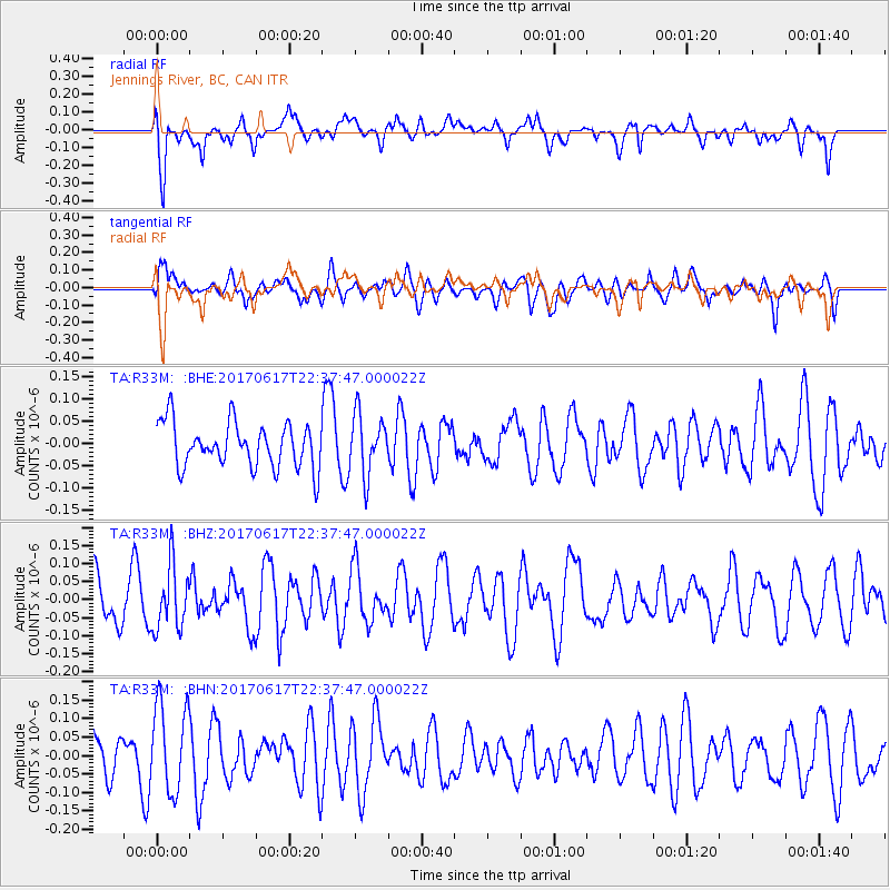
R33M Jennings River, BC, CAN - Earthquake Result Viewer
*The percent match for this event was below the threshold and hence no stack was calculated.
| Earthquake location: |
South Of Fiji Islands |
| Earthquake latitude/longitude: |
-24.1/179.6 |
| Earthquake time(UTC): |
2017/06/17 (168) 22:26:02 GMT |
| Earthquake Depth: |
518 km |
| Earthquake Magnitude: |
6.1 Mww |
| Earthquake Catalog/Contributor: |
NEIC PDE/us |
|
| Network: |
TA USArray Transportable Network (new EarthScope stations) |
| Station: |
R33M Jennings River, BC, CAN |
| Lat/Lon: |
59.39 N/130.97 W |
| Elevation: |
1437 m |
|
| Distance: |
92.6 deg |
| Az: |
22.9 deg |
| Baz: |
224.025 deg |
| Ray Param: |
$rayparam |
*The percent match for this event was below the threshold and hence was not used in the summary stack. |
|
| Radial Match: |
61.55172 % |
| Radial Bump: |
400 |
| Transverse Match: |
52.7161 % |
| Transverse Bump: |
400 |
| SOD ConfigId: |
13570011 |
| Insert Time: |
2019-04-28 05:48:39.619 +0000 |
| GWidth: |
2.5 |
| Max Bumps: |
400 |
| Tol: |
0.001 |
|
Signal To Noise
| Channel | StoN | STA | LTA |
| TA:R33M: :BHZ:20170617T22:37:47.000022Z | 0.868237 | 8.891799E-8 | 1.0241212E-7 |
| TA:R33M: :BHN:20170617T22:37:47.000022Z | 2.2540276 | 1.2040809E-7 | 5.3419082E-8 |
| TA:R33M: :BHE:20170617T22:37:47.000022Z | 1.3610365 | 6.767277E-8 | 4.9721493E-8 |
| Arrivals |
| Ps | |
| PpPs | |
| PsPs/PpSs | |


