E07A Sunnyside, WA, USA - Earthquake Result Viewer
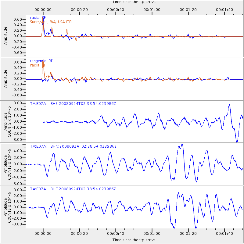
Earthquake location: Off Coast Of Jalisco, Mexico
Earthquake latitude/longitude: 17.6/-105.5
Earthquake time(UTC): 2008/09/24 (268) 02:33:05 GMT
Earthquake Depth: 10 km
Earthquake Magnitude: 5.7 MB, 6.2 MS, 6.4 MW, 6.4 MW
Earthquake Catalog/Contributor: WHDF/NEIC
Network: TA USArray Transportable Network (new EarthScope stations)
Station: E07A Sunnyside, WA, USA
Lat/Lon: 46.56 N/119.85 W
Elevation: 561 m
Distance: 31.2 deg
Az: 340.728 deg
Baz: 152.86 deg
Ray Param: 0.07912625
Estimated Moho Depth: 30.25 km
Estimated Crust Vp/Vs: 1.86
Assumed Crust Vp: 6.419 km/s
Estimated Crust Vs: 3.451 km/s
Estimated Crust Poisson's Ratio: 0.30
Radial Match: 89.60172 %
Radial Bump: 251
Transverse Match: 75.40673 %
Transverse Bump: 400
SOD ConfigId: 2560
Insert Time: 2010-03-06 01:05:13.098 +0000
GWidth: 2.5
Max Bumps: 400
Tol: 0.001

Signal To Noise

ChannelStoNSTALTA
TA:E07A: :BHN:20080924T02:38:54.023986Z22.5923711.6577742E-67.337761E-8
TA:E07A: :BHE:20080924T02:38:54.023986Z11.9159167.753073E-76.506485E-8
TA:E07A: :BHZ:20080924T02:38:54.023986Z7.18824675.011265E-76.971471E-8
Arrivals
Ps4.4 SECOND
PpPs12 SECOND
PsPs/PpSs17 SECOND