You are here: Home > Network List > UW - Pacific Northwest Regional Seismic Network Stations List
> Station FISH Seaside, OR, USA > Earthquake Result Viewer
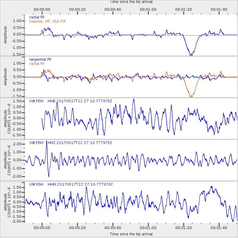
FISH Seaside, OR, USA - Earthquake Result Viewer
*The percent match for this event was below the threshold and hence no stack was calculated.
| Earthquake location: |
South Of Fiji Islands |
| Earthquake latitude/longitude: |
-24.1/179.6 |
| Earthquake time(UTC): |
2017/06/17 (168) 22:26:02 GMT |
| Earthquake Depth: |
518 km |
| Earthquake Magnitude: |
6.1 Mww |
| Earthquake Catalog/Contributor: |
NEIC PDE/us |
|
| Network: |
UW Pacific Northwest Regional Seismic Network |
| Station: |
FISH Seaside, OR, USA |
| Lat/Lon: |
45.93 N/123.56 W |
| Elevation: |
325 m |
|
| Distance: |
86.7 deg |
| Az: |
35.826 deg |
| Baz: |
230.029 deg |
| Ray Param: |
$rayparam |
*The percent match for this event was below the threshold and hence was not used in the summary stack. |
|
| Radial Match: |
22.531599 % |
| Radial Bump: |
400 |
| Transverse Match: |
40.222416 % |
| Transverse Bump: |
400 |
| SOD ConfigId: |
13570011 |
| Insert Time: |
2019-04-28 05:49:21.117 +0000 |
| GWidth: |
2.5 |
| Max Bumps: |
400 |
| Tol: |
0.001 |
|
Signal To Noise
| Channel | StoN | STA | LTA |
| UW:FISH: :HHZ:20170617T22:37:19.777976Z | 2.4675794 | 1.0132712E-6 | 4.1063367E-7 |
| UW:FISH: :HHN:20170617T22:37:19.777976Z | 1.4521159 | 6.5041144E-7 | 4.4790602E-7 |
| UW:FISH: :HHE:20170617T22:37:19.777976Z | 1.3170424 | 7.023961E-7 | 5.3331325E-7 |
| Arrivals |
| Ps | |
| PpPs | |
| PsPs/PpSs | |


