You are here: Home > Network List > UW - Pacific Northwest Regional Seismic Network Stations List
> Station UMAT Pilot Rock, OR, USA > Earthquake Result Viewer
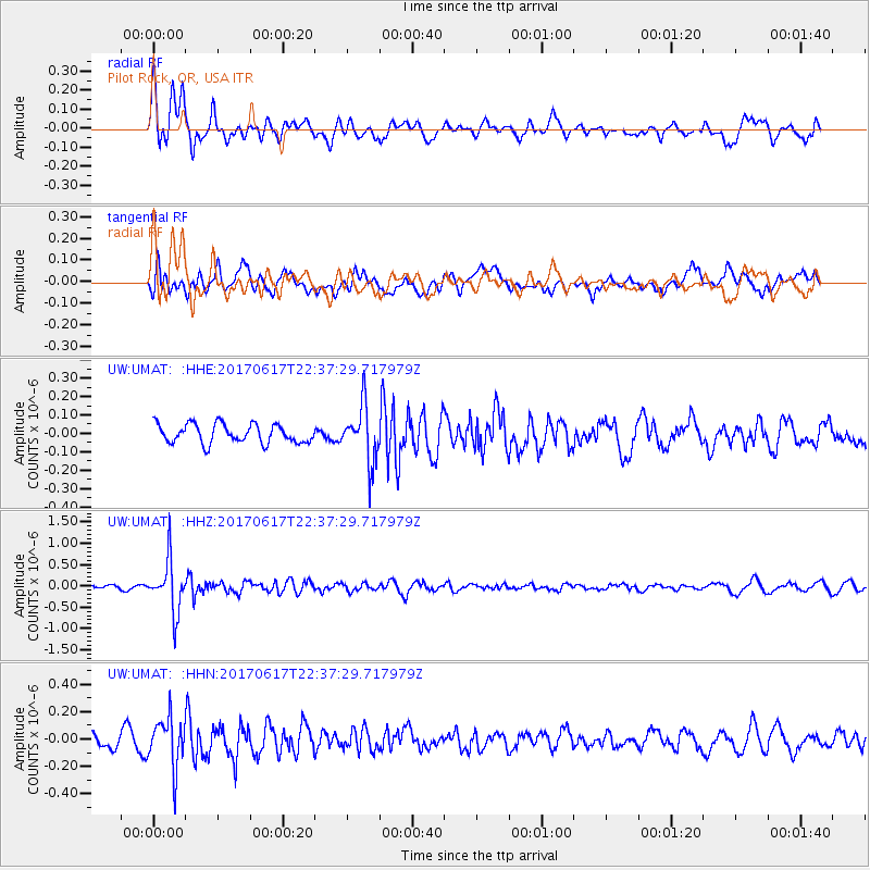
UMAT Pilot Rock, OR, USA - Earthquake Result Viewer
*The percent match for this event was below the threshold and hence no stack was calculated.
| Earthquake location: |
South Of Fiji Islands |
| Earthquake latitude/longitude: |
-24.1/179.6 |
| Earthquake time(UTC): |
2017/06/17 (168) 22:26:02 GMT |
| Earthquake Depth: |
518 km |
| Earthquake Magnitude: |
6.1 Mww |
| Earthquake Catalog/Contributor: |
NEIC PDE/us |
|
| Network: |
UW Pacific Northwest Regional Seismic Network |
| Station: |
UMAT Pilot Rock, OR, USA |
| Lat/Lon: |
45.29 N/118.96 W |
| Elevation: |
1318 m |
|
| Distance: |
88.8 deg |
| Az: |
38.33 deg |
| Baz: |
233.405 deg |
| Ray Param: |
$rayparam |
*The percent match for this event was below the threshold and hence was not used in the summary stack. |
|
| Radial Match: |
70.83731 % |
| Radial Bump: |
400 |
| Transverse Match: |
56.47263 % |
| Transverse Bump: |
400 |
| SOD ConfigId: |
13570011 |
| Insert Time: |
2019-04-28 05:49:37.063 +0000 |
| GWidth: |
2.5 |
| Max Bumps: |
400 |
| Tol: |
0.001 |
|
Signal To Noise
| Channel | StoN | STA | LTA |
| UW:UMAT: :HHZ:20170617T22:37:29.717979Z | 10.792624 | 5.946386E-7 | 5.509676E-8 |
| UW:UMAT: :HHN:20170617T22:37:29.717979Z | 3.2850168 | 1.7990162E-7 | 5.4764293E-8 |
| UW:UMAT: :HHE:20170617T22:37:29.717979Z | 3.013018 | 1.54292E-7 | 5.1208456E-8 |
| Arrivals |
| Ps | |
| PpPs | |
| PsPs/PpSs | |


