You are here: Home > Network List > CI - Caltech Regional Seismic Network Stations List
> Station MPM Manuel Prospect Mine, California, USA > Earthquake Result Viewer
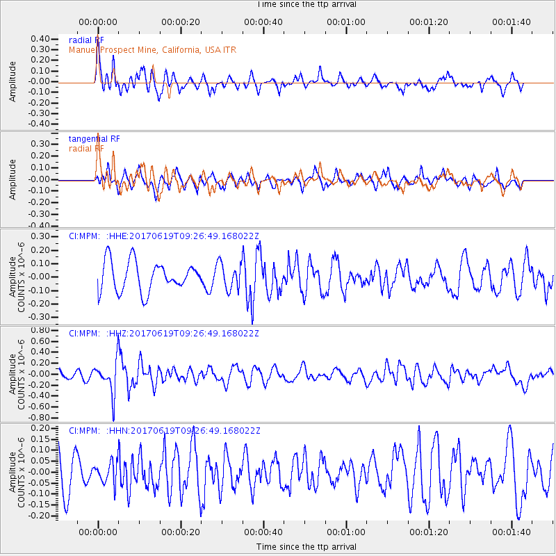
MPM Manuel Prospect Mine, California, USA - Earthquake Result Viewer
*The percent match for this event was below the threshold and hence no stack was calculated.
| Earthquake location: |
Fiji Islands Region |
| Earthquake latitude/longitude: |
-20.7/-176.5 |
| Earthquake time(UTC): |
2017/06/19 (170) 09:15:43 GMT |
| Earthquake Depth: |
264 km |
| Earthquake Magnitude: |
5.8 Mww |
| Earthquake Catalog/Contributor: |
NEIC PDE/us |
|
| Network: |
CI Caltech Regional Seismic Network |
| Station: |
MPM Manuel Prospect Mine, California, USA |
| Lat/Lon: |
36.06 N/117.49 W |
| Elevation: |
185 m |
|
| Distance: |
79.4 deg |
| Az: |
44.96 deg |
| Baz: |
234.712 deg |
| Ray Param: |
$rayparam |
*The percent match for this event was below the threshold and hence was not used in the summary stack. |
|
| Radial Match: |
66.300186 % |
| Radial Bump: |
388 |
| Transverse Match: |
59.084747 % |
| Transverse Bump: |
400 |
| SOD ConfigId: |
13570011 |
| Insert Time: |
2019-04-28 05:53:25.714 +0000 |
| GWidth: |
2.5 |
| Max Bumps: |
400 |
| Tol: |
0.001 |
|
Signal To Noise
| Channel | StoN | STA | LTA |
| CI:MPM: :HHZ:20170619T09:26:49.168022Z | 4.0207825 | 3.010913E-7 | 7.488376E-8 |
| CI:MPM: :HHN:20170619T09:26:49.168022Z | 0.57513505 | 4.96355E-8 | 8.630234E-8 |
| CI:MPM: :HHE:20170619T09:26:49.168022Z | 0.88614506 | 9.740261E-8 | 1.0991724E-7 |
| Arrivals |
| Ps | |
| PpPs | |
| PsPs/PpSs | |


