You are here: Home > Network List > CN - Canadian National Seismograph Network Stations List
> Station INK INUVIK, NT > Earthquake Result Viewer
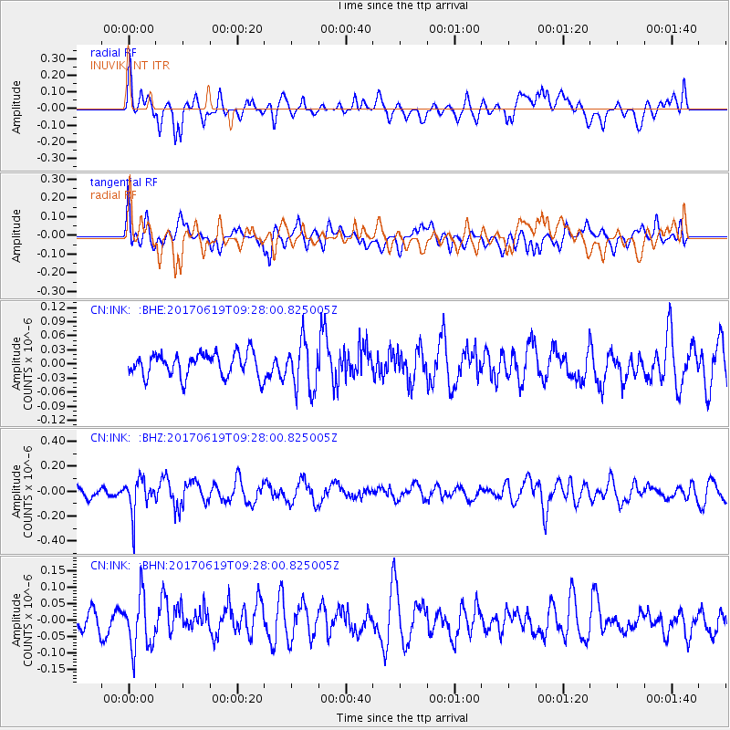
INK INUVIK, NT - Earthquake Result Viewer
*The percent match for this event was below the threshold and hence no stack was calculated.
| Earthquake location: |
Fiji Islands Region |
| Earthquake latitude/longitude: |
-20.7/-176.5 |
| Earthquake time(UTC): |
2017/06/19 (170) 09:15:43 GMT |
| Earthquake Depth: |
264 km |
| Earthquake Magnitude: |
5.8 Mww |
| Earthquake Catalog/Contributor: |
NEIC PDE/us |
|
| Network: |
CN Canadian National Seismograph Network |
| Station: |
INK INUVIK, NT |
| Lat/Lon: |
68.31 N/133.53 W |
| Elevation: |
44 m |
|
| Distance: |
94.1 deg |
| Az: |
14.714 deg |
| Baz: |
219.751 deg |
| Ray Param: |
$rayparam |
*The percent match for this event was below the threshold and hence was not used in the summary stack. |
|
| Radial Match: |
60.64739 % |
| Radial Bump: |
400 |
| Transverse Match: |
54.905643 % |
| Transverse Bump: |
400 |
| SOD ConfigId: |
13570011 |
| Insert Time: |
2019-04-28 05:53:52.954 +0000 |
| GWidth: |
2.5 |
| Max Bumps: |
400 |
| Tol: |
0.001 |
|
Signal To Noise
| Channel | StoN | STA | LTA |
| CN:INK: :BHZ:20170619T09:28:00.825005Z | 2.3058643 | 1.3759853E-7 | 5.9673305E-8 |
| CN:INK: :BHN:20170619T09:28:00.825005Z | 2.11537 | 8.17352E-8 | 3.8638724E-8 |
| CN:INK: :BHE:20170619T09:28:00.825005Z | 2.0858846 | 5.1839002E-8 | 2.4852287E-8 |
| Arrivals |
| Ps | |
| PpPs | |
| PsPs/PpSs | |


