U16A Tuba City, AZ, USA - Earthquake Result Viewer
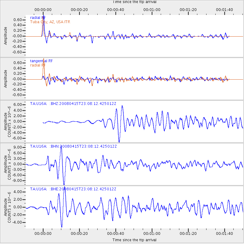
Earthquake location: Andreanof Islands, Aleutian Is.
Earthquake latitude/longitude: 51.9/-179.4
Earthquake time(UTC): 2008/04/15 (106) 22:59:51 GMT
Earthquake Depth: 10 km
Earthquake Magnitude: 6.1 MB, 6.4 MS, 6.4 MW, 6.4 MW
Earthquake Catalog/Contributor: WHDF/NEIC
Network: TA USArray Transportable Network (new EarthScope stations)
Station: U16A Tuba City, AZ, USA
Lat/Lon: 36.14 N/111.13 W
Elevation: 1544 m
Distance: 49.7 deg
Az: 80.284 deg
Baz: 310.951 deg
Ray Param: 0.06853585
Estimated Moho Depth: 49.25 km
Estimated Crust Vp/Vs: 1.78
Assumed Crust Vp: 6.247 km/s
Estimated Crust Vs: 3.509 km/s
Estimated Crust Poisson's Ratio: 0.27
Radial Match: 93.67061 %
Radial Bump: 337
Transverse Match: 87.07149 %
Transverse Bump: 400
SOD ConfigId: 2504
Insert Time: 2010-03-06 01:07:20.712 +0000
GWidth: 2.5
Max Bumps: 400
Tol: 0.001

Signal To Noise

ChannelStoNSTALTA
TA:U16A: :BHN:20080415T23:08:12.425012Z8.8311971.8505806E-62.0955038E-7
TA:U16A: :BHE:20080415T23:08:12.425012Z4.32099638.794599E-72.0353174E-7
TA:U16A: :BHZ:20080415T23:08:12.425012Z3.91190558.63125E-72.2064056E-7
Arrivals
Ps6.5 SECOND
PpPs21 SECOND
PsPs/PpSs27 SECOND