You are here: Home > Network List > TA - USArray Transportable Network (new EarthScope stations) Stations List
> Station I17K Unalakleet, AK, USA > Earthquake Result Viewer
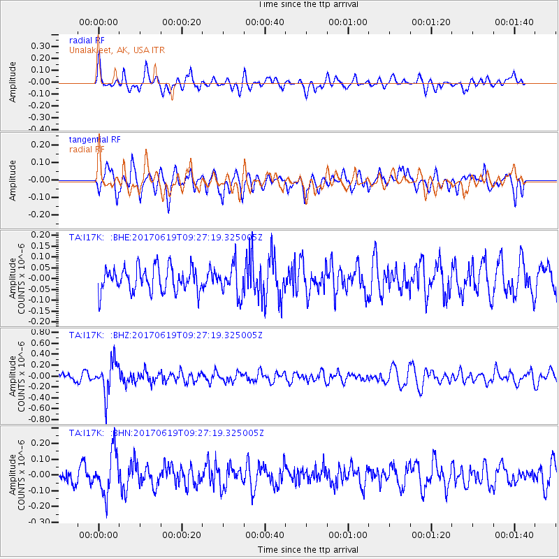
I17K Unalakleet, AK, USA - Earthquake Result Viewer
*The percent match for this event was below the threshold and hence no stack was calculated.
| Earthquake location: |
Fiji Islands Region |
| Earthquake latitude/longitude: |
-20.7/-176.5 |
| Earthquake time(UTC): |
2017/06/19 (170) 09:15:43 GMT |
| Earthquake Depth: |
264 km |
| Earthquake Magnitude: |
5.8 Mww |
| Earthquake Catalog/Contributor: |
NEIC PDE/us |
|
| Network: |
TA USArray Transportable Network (new EarthScope stations) |
| Station: |
I17K Unalakleet, AK, USA |
| Lat/Lon: |
63.89 N/160.70 W |
| Elevation: |
105 m |
|
| Distance: |
85.2 deg |
| Az: |
6.937 deg |
| Baz: |
194.801 deg |
| Ray Param: |
$rayparam |
*The percent match for this event was below the threshold and hence was not used in the summary stack. |
|
| Radial Match: |
57.02406 % |
| Radial Bump: |
400 |
| Transverse Match: |
66.07715 % |
| Transverse Bump: |
400 |
| SOD ConfigId: |
13570011 |
| Insert Time: |
2019-04-28 05:57:01.768 +0000 |
| GWidth: |
2.5 |
| Max Bumps: |
400 |
| Tol: |
0.001 |
|
Signal To Noise
| Channel | StoN | STA | LTA |
| TA:I17K: :BHZ:20170619T09:27:19.325005Z | 5.7255287 | 3.0188718E-7 | 5.2726516E-8 |
| TA:I17K: :BHN:20170619T09:27:19.325005Z | 2.757131 | 1.3562371E-7 | 4.9190156E-8 |
| TA:I17K: :BHE:20170619T09:27:19.325005Z | 1.2642307 | 7.033659E-8 | 5.5635876E-8 |
| Arrivals |
| Ps | |
| PpPs | |
| PsPs/PpSs | |


