You are here: Home > Network List > TA - USArray Transportable Network (new EarthScope stations) Stations List
> Station J26L Joseph Creek, AK, USA > Earthquake Result Viewer
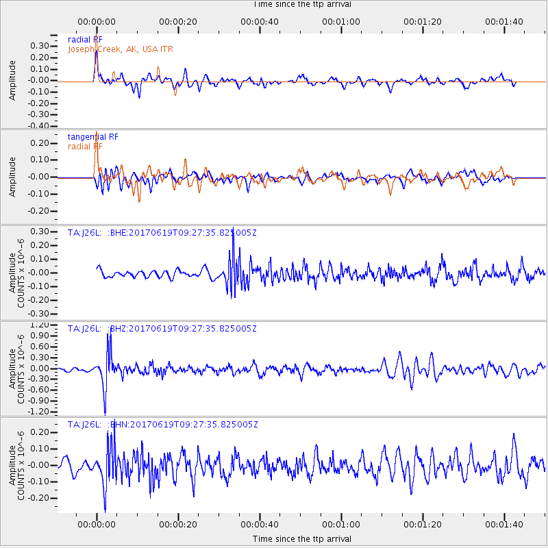
J26L Joseph Creek, AK, USA - Earthquake Result Viewer
*The percent match for this event was below the threshold and hence no stack was calculated.
| Earthquake location: |
Fiji Islands Region |
| Earthquake latitude/longitude: |
-20.7/-176.5 |
| Earthquake time(UTC): |
2017/06/19 (170) 09:15:43 GMT |
| Earthquake Depth: |
264 km |
| Earthquake Magnitude: |
5.8 Mww |
| Earthquake Catalog/Contributor: |
NEIC PDE/us |
|
| Network: |
TA USArray Transportable Network (new EarthScope stations) |
| Station: |
J26L Joseph Creek, AK, USA |
| Lat/Lon: |
64.50 N/143.56 W |
| Elevation: |
1144 m |
|
| Distance: |
88.7 deg |
| Az: |
13.607 deg |
| Baz: |
210.58 deg |
| Ray Param: |
$rayparam |
*The percent match for this event was below the threshold and hence was not used in the summary stack. |
|
| Radial Match: |
62.98336 % |
| Radial Bump: |
400 |
| Transverse Match: |
55.015747 % |
| Transverse Bump: |
400 |
| SOD ConfigId: |
13570011 |
| Insert Time: |
2019-04-28 05:57:10.201 +0000 |
| GWidth: |
2.5 |
| Max Bumps: |
400 |
| Tol: |
0.001 |
|
Signal To Noise
| Channel | StoN | STA | LTA |
| TA:J26L: :BHZ:20170619T09:27:35.825005Z | 12.274152 | 4.912553E-7 | 4.002357E-8 |
| TA:J26L: :BHN:20170619T09:27:35.825005Z | 4.1227837 | 1.1965368E-7 | 2.9022548E-8 |
| TA:J26L: :BHE:20170619T09:27:35.825005Z | 4.5250473 | 1.0327551E-7 | 2.2823079E-8 |
| Arrivals |
| Ps | |
| PpPs | |
| PsPs/PpSs | |


