U16A Tuba City, AZ, USA - Earthquake Result Viewer
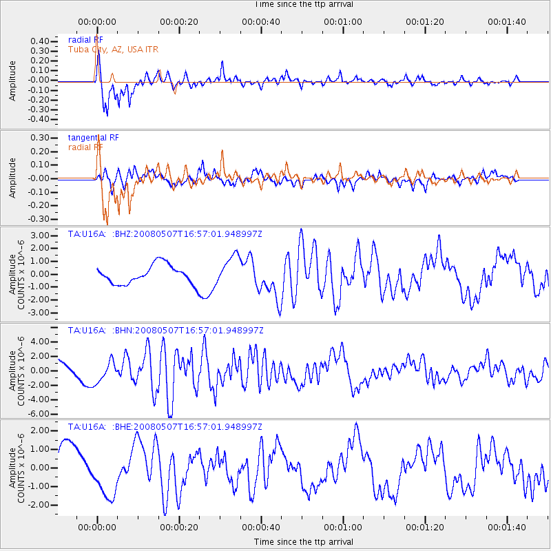
Earthquake location: Near East Coast Of Honshu, Japan
Earthquake latitude/longitude: 36.2/141.5
Earthquake time(UTC): 2008/05/07 (128) 16:45:20 GMT
Earthquake Depth: 39 km
Earthquake Magnitude: 6.1 MB, 6.7 MS, 6.8 MW, 6.8 MW
Earthquake Catalog/Contributor: WHDF/NEIC
Network: TA USArray Transportable Network (new EarthScope stations)
Station: U16A Tuba City, AZ, USA
Lat/Lon: 36.14 N/111.13 W
Elevation: 1544 m
Distance: 81.4 deg
Az: 51.389 deg
Baz: 308.625 deg
Ray Param: 0.047556367
Estimated Moho Depth: 68.75 km
Estimated Crust Vp/Vs: 1.84
Assumed Crust Vp: 6.247 km/s
Estimated Crust Vs: 3.399 km/s
Estimated Crust Poisson's Ratio: 0.29
Radial Match: 96.32328 %
Radial Bump: 370
Transverse Match: 75.07638 %
Transverse Bump: 400
SOD ConfigId: 2504
Insert Time: 2010-03-06 01:07:37.524 +0000
GWidth: 2.5
Max Bumps: 400
Tol: 0.001

Signal To Noise

ChannelStoNSTALTA
TA:U16A: :BHN:20080507T16:57:01.948997Z1.18729091.4610216E-61.2305507E-6
TA:U16A: :BHE:20080507T16:57:01.948997Z1.33950031.3364212E-69.977012E-7
TA:U16A: :BHZ:20080507T16:57:01.948997Z1.6484491.1943847E-67.2455066E-7
Arrivals
Ps9.4 SECOND
PpPs30 SECOND
PsPs/PpSs40 SECOND