You are here: Home > Network List > TA - USArray Transportable Network (new EarthScope stations) Stations List
> Station O17K Koliganek, Bristol Bay, AK, USA > Earthquake Result Viewer
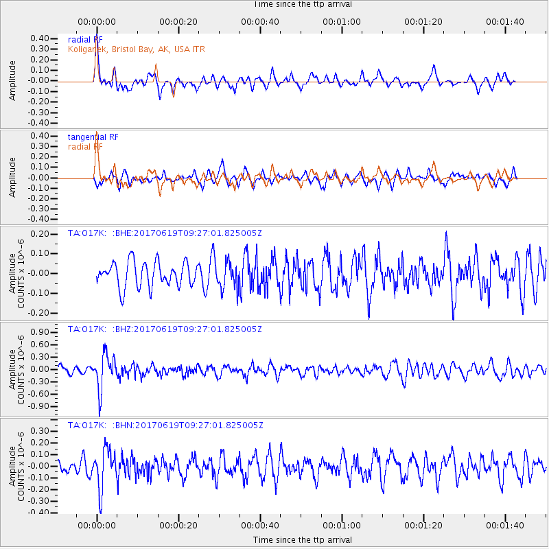
O17K Koliganek, Bristol Bay, AK, USA - Earthquake Result Viewer
*The percent match for this event was below the threshold and hence no stack was calculated.
| Earthquake location: |
Fiji Islands Region |
| Earthquake latitude/longitude: |
-20.7/-176.5 |
| Earthquake time(UTC): |
2017/06/19 (170) 09:15:43 GMT |
| Earthquake Depth: |
264 km |
| Earthquake Magnitude: |
5.8 Mww |
| Earthquake Catalog/Contributor: |
NEIC PDE/us |
|
| Network: |
TA USArray Transportable Network (new EarthScope stations) |
| Station: |
O17K Koliganek, Bristol Bay, AK, USA |
| Lat/Lon: |
59.77 N/157.09 W |
| Elevation: |
156 m |
|
| Distance: |
81.8 deg |
| Az: |
9.768 deg |
| Baz: |
198.293 deg |
| Ray Param: |
$rayparam |
*The percent match for this event was below the threshold and hence was not used in the summary stack. |
|
| Radial Match: |
72.179016 % |
| Radial Bump: |
392 |
| Transverse Match: |
60.348583 % |
| Transverse Bump: |
372 |
| SOD ConfigId: |
13570011 |
| Insert Time: |
2019-04-28 05:57:49.899 +0000 |
| GWidth: |
2.5 |
| Max Bumps: |
400 |
| Tol: |
0.001 |
|
Signal To Noise
| Channel | StoN | STA | LTA |
| TA:O17K: :BHZ:20170619T09:27:01.825005Z | 5.790799 | 4.2824092E-7 | 7.395195E-8 |
| TA:O17K: :BHN:20170619T09:27:01.825005Z | 3.531952 | 1.7493615E-7 | 4.9529596E-8 |
| TA:O17K: :BHE:20170619T09:27:01.825005Z | 1.0543041 | 6.549404E-8 | 6.2120634E-8 |
| Arrivals |
| Ps | |
| PpPs | |
| PsPs/PpSs | |


