You are here: Home > Network List > TA - USArray Transportable Network (new EarthScope stations) Stations List
> Station P17K Kvichak River, AK, USA > Earthquake Result Viewer
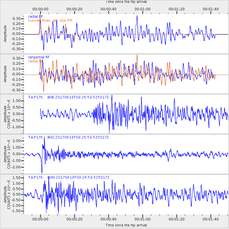
P17K Kvichak River, AK, USA - Earthquake Result Viewer
*The percent match for this event was below the threshold and hence no stack was calculated.
| Earthquake location: |
Fiji Islands Region |
| Earthquake latitude/longitude: |
-20.7/-176.5 |
| Earthquake time(UTC): |
2017/06/19 (170) 09:15:43 GMT |
| Earthquake Depth: |
264 km |
| Earthquake Magnitude: |
5.8 Mww |
| Earthquake Catalog/Contributor: |
NEIC PDE/us |
|
| Network: |
TA USArray Transportable Network (new EarthScope stations) |
| Station: |
P17K Kvichak River, AK, USA |
| Lat/Lon: |
59.20 N/156.44 W |
| Elevation: |
91 m |
|
| Distance: |
81.3 deg |
| Az: |
10.275 deg |
| Baz: |
198.931 deg |
| Ray Param: |
$rayparam |
*The percent match for this event was below the threshold and hence was not used in the summary stack. |
|
| Radial Match: |
64.448654 % |
| Radial Bump: |
400 |
| Transverse Match: |
62.00984 % |
| Transverse Bump: |
400 |
| SOD ConfigId: |
13570011 |
| Insert Time: |
2019-04-28 05:57:55.746 +0000 |
| GWidth: |
2.5 |
| Max Bumps: |
400 |
| Tol: |
0.001 |
|
Signal To Noise
| Channel | StoN | STA | LTA |
| TA:P17K: :BHZ:20170619T09:26:59.525017Z | 9.6802225 | 1.0915338E-6 | 1.1275916E-7 |
| TA:P17K: :BHN:20170619T09:26:59.525017Z | 3.0956328 | 6.402644E-7 | 2.0682828E-7 |
| TA:P17K: :BHE:20170619T09:26:59.525017Z | 1.8322734 | 3.569717E-7 | 1.9482447E-7 |
| Arrivals |
| Ps | |
| PpPs | |
| PsPs/PpSs | |


