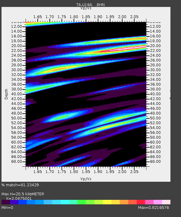
U16A Tuba City, AZ, USA - Earthquake Result Viewer
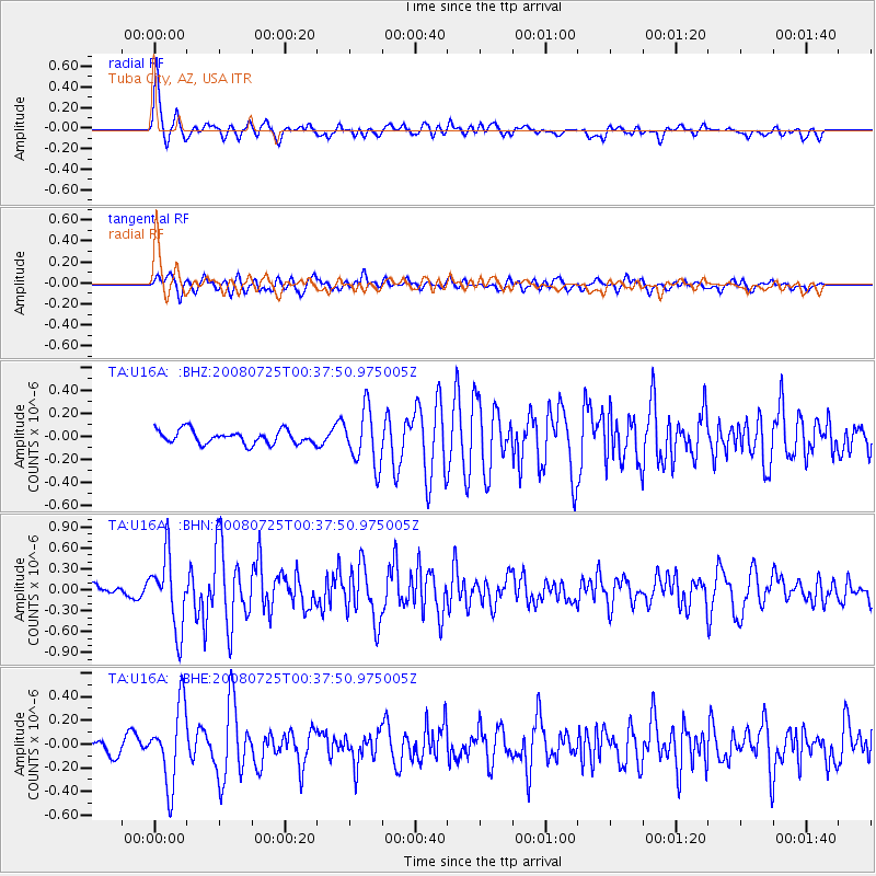
Earthquake location: Rat Islands, Aleutian Islands
Earthquake latitude/longitude: 51.3/179.0
Earthquake time(UTC): 2008/07/25 (207) 00:29:22 GMT
Earthquake Depth: 21 km
Earthquake Magnitude: 5.7 MB, 5.5 MS, 5.9 MW, 5.9 MW
Earthquake Catalog/Contributor: WHDF/NEIC
Network: TA USArray Transportable Network (new EarthScope stations)
Station: U16A Tuba City, AZ, USA
Lat/Lon: 36.14 N/111.13 W
Elevation: 1544 m
Distance: 50.8 deg
Az: 78.673 deg
Baz: 310.461 deg
Ray Param: 0.06777272
Estimated Moho Depth: 20.5 km
Estimated Crust Vp/Vs: 2.05
Assumed Crust Vp: 6.247 km/s
Estimated Crust Vs: 3.051 km/s
Estimated Crust Poisson's Ratio: 0.34
Radial Match: 81.23429 %
Radial Bump: 400
Transverse Match: 67.95337 %
Transverse Bump: 400
SOD ConfigId: 2504
Insert Time: 2010-03-06 01:07:57.050 +0000
GWidth: 2.5
Max Bumps: 400
Tol: 0.001

Signal To Noise

ChannelStoNSTALTA
TA:U16A: :BHN:20080725T00:37:50.975005Z6.19670155.1678995E-78.339759E-8
TA:U16A: :BHE:20080725T00:37:50.975005Z3.81486633.2640781E-78.556206E-8
TA:U16A: :BHZ:20080725T00:37:50.975005Z4.1403942.422973E-75.852034E-8
Arrivals
Ps3.6 SECOND
PpPs9.5 SECOND
PsPs/PpSs13 SECOND