You are here: Home > Network List > UW - Pacific Northwest Regional Seismic Network Stations List
> Station MRBL Marblemount, WA, USA > Earthquake Result Viewer
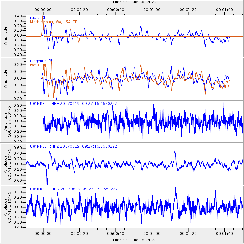
MRBL Marblemount, WA, USA - Earthquake Result Viewer
*The percent match for this event was below the threshold and hence no stack was calculated.
| Earthquake location: |
Fiji Islands Region |
| Earthquake latitude/longitude: |
-20.7/-176.5 |
| Earthquake time(UTC): |
2017/06/19 (170) 09:15:43 GMT |
| Earthquake Depth: |
264 km |
| Earthquake Magnitude: |
5.8 Mww |
| Earthquake Catalog/Contributor: |
NEIC PDE/us |
|
| Network: |
UW Pacific Northwest Regional Seismic Network |
| Station: |
MRBL Marblemount, WA, USA |
| Lat/Lon: |
48.52 N/121.48 W |
| Elevation: |
75 m |
|
| Distance: |
84.6 deg |
| Az: |
33.162 deg |
| Baz: |
230.364 deg |
| Ray Param: |
$rayparam |
*The percent match for this event was below the threshold and hence was not used in the summary stack. |
|
| Radial Match: |
61.533333 % |
| Radial Bump: |
400 |
| Transverse Match: |
52.229435 % |
| Transverse Bump: |
400 |
| SOD ConfigId: |
13570011 |
| Insert Time: |
2019-04-28 05:59:05.158 +0000 |
| GWidth: |
2.5 |
| Max Bumps: |
400 |
| Tol: |
0.001 |
|
Signal To Noise
| Channel | StoN | STA | LTA |
| UW:MRBL: :HHZ:20170619T09:27:16.168022Z | 4.405827 | 2.8915827E-7 | 6.563087E-8 |
| UW:MRBL: :HHN:20170619T09:27:16.168022Z | 1.4581171 | 1.2123472E-7 | 8.3144705E-8 |
| UW:MRBL: :HHE:20170619T09:27:16.168022Z | 1.0306184 | 9.091937E-8 | 8.821827E-8 |
| Arrivals |
| Ps | |
| PpPs | |
| PsPs/PpSs | |


