You are here: Home > Network List > CI - Caltech Regional Seismic Network Stations List
> Station MPM Manuel Prospect Mine, California, USA > Earthquake Result Viewer
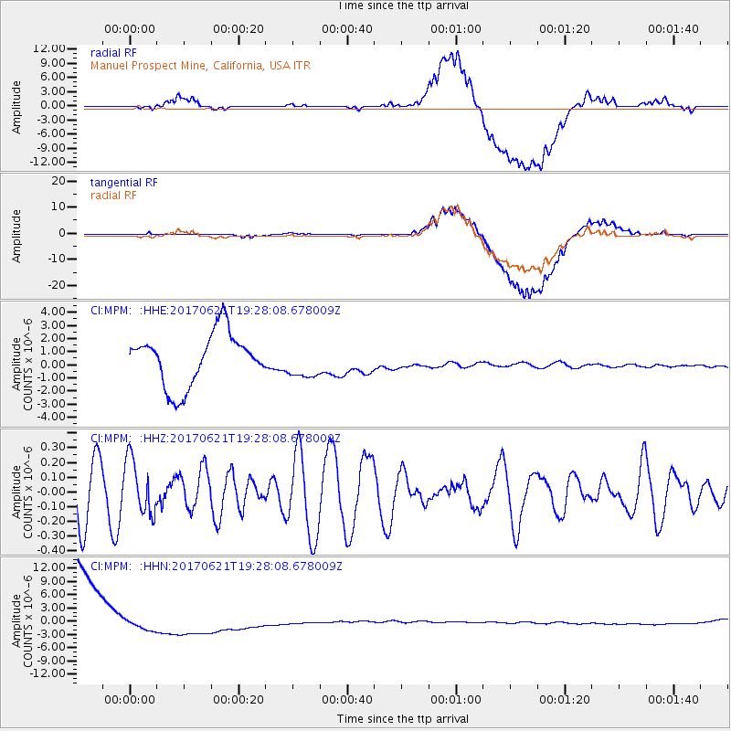
MPM Manuel Prospect Mine, California, USA - Earthquake Result Viewer
*The percent match for this event was below the threshold and hence no stack was calculated.
| Earthquake location: |
Rat Islands, Aleutian Islands |
| Earthquake latitude/longitude: |
51.8/179.4 |
| Earthquake time(UTC): |
2017/06/21 (172) 19:20:26 GMT |
| Earthquake Depth: |
165 km |
| Earthquake Magnitude: |
5.5 Mb |
| Earthquake Catalog/Contributor: |
NEIC PDE/at |
|
| Network: |
CI Caltech Regional Seismic Network |
| Station: |
MPM Manuel Prospect Mine, California, USA |
| Lat/Lon: |
36.06 N/117.49 W |
| Elevation: |
185 m |
|
| Distance: |
46.6 deg |
| Az: |
83.993 deg |
| Baz: |
310.397 deg |
| Ray Param: |
$rayparam |
*The percent match for this event was below the threshold and hence was not used in the summary stack. |
|
| Radial Match: |
65.183754 % |
| Radial Bump: |
400 |
| Transverse Match: |
70.21577 % |
| Transverse Bump: |
400 |
| SOD ConfigId: |
13570011 |
| Insert Time: |
2019-04-28 06:01:08.061 +0000 |
| GWidth: |
2.5 |
| Max Bumps: |
400 |
| Tol: |
0.001 |
|
Signal To Noise
| Channel | StoN | STA | LTA |
| CI:MPM: :HHZ:20170621T19:28:08.678009Z | 1.2173585 | 1.88419E-7 | 1.5477693E-7 |
| CI:MPM: :HHN:20170621T19:28:08.678009Z | 0.123263 | 1.2576625E-6 | 1.0203082E-5 |
| CI:MPM: :HHE:20170621T19:28:08.678009Z | 0.6102011 | 1.2415614E-6 | 2.0346758E-6 |
| Arrivals |
| Ps | |
| PpPs | |
| PsPs/PpSs | |


