You are here: Home > Network List > GM - US Geological Survey Networks Stations List
> Station IWM01 Jericho 2M Well Monitoring Station > Earthquake Result Viewer
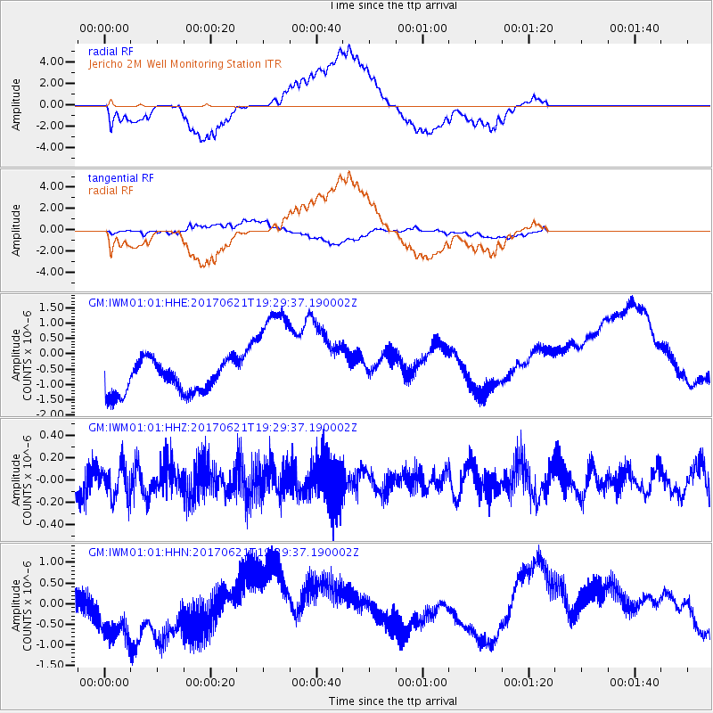
IWM01 Jericho 2M Well Monitoring Station - Earthquake Result Viewer
*The percent match for this event was below the threshold and hence no stack was calculated.
| Earthquake location: |
Rat Islands, Aleutian Islands |
| Earthquake latitude/longitude: |
51.8/179.4 |
| Earthquake time(UTC): |
2017/06/21 (172) 19:20:26 GMT |
| Earthquake Depth: |
165 km |
| Earthquake Magnitude: |
5.5 Mb |
| Earthquake Catalog/Contributor: |
NEIC PDE/at |
|
| Network: |
GM US Geological Survey Networks |
| Station: |
IWM01 Jericho 2M Well Monitoring Station |
| Lat/Lon: |
36.73 N/96.53 W |
| Elevation: |
328 m |
|
| Distance: |
58.8 deg |
| Az: |
69.164 deg |
| Baz: |
313.794 deg |
| Ray Param: |
$rayparam |
*The percent match for this event was below the threshold and hence was not used in the summary stack. |
|
| Radial Match: |
49.530174 % |
| Radial Bump: |
400 |
| Transverse Match: |
25.361734 % |
| Transverse Bump: |
400 |
| SOD ConfigId: |
13570011 |
| Insert Time: |
2019-04-28 06:02:34.448 +0000 |
| GWidth: |
2.5 |
| Max Bumps: |
400 |
| Tol: |
0.001 |
|
Signal To Noise
| Channel | StoN | STA | LTA |
| GM:IWM01:01:HHZ:20170621T19:29:37.190002Z | 0.9787908 | 1.4628041E-7 | 1.4945013E-7 |
| GM:IWM01:01:HHN:20170621T19:29:37.190002Z | 2.8422983 | 1.353554E-6 | 4.762181E-7 |
| GM:IWM01:01:HHE:20170621T19:29:37.190002Z | 3.6660612 | 1.8204742E-6 | 4.9657496E-7 |
| Arrivals |
| Ps | |
| PpPs | |
| PsPs/PpSs | |


