You are here: Home > Network List > IU - Global Seismograph Network (GSN - IRIS/USGS) Stations List
> Station JOHN Johnston Island, USA > Earthquake Result Viewer
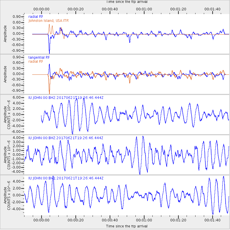
JOHN Johnston Island, USA - Earthquake Result Viewer
*The percent match for this event was below the threshold and hence no stack was calculated.
| Earthquake location: |
Rat Islands, Aleutian Islands |
| Earthquake latitude/longitude: |
51.8/179.4 |
| Earthquake time(UTC): |
2017/06/21 (172) 19:20:26 GMT |
| Earthquake Depth: |
165 km |
| Earthquake Magnitude: |
5.5 Mb |
| Earthquake Catalog/Contributor: |
NEIC PDE/at |
|
| Network: |
IU Global Seismograph Network (GSN - IRIS/USGS) |
| Station: |
JOHN Johnston Island, USA |
| Lat/Lon: |
16.73 N/169.53 W |
| Elevation: |
2.0 m |
|
| Distance: |
36.1 deg |
| Az: |
161.841 deg |
| Baz: |
348.357 deg |
| Ray Param: |
$rayparam |
*The percent match for this event was below the threshold and hence was not used in the summary stack. |
|
| Radial Match: |
54.53845 % |
| Radial Bump: |
400 |
| Transverse Match: |
45.076706 % |
| Transverse Bump: |
400 |
| SOD ConfigId: |
13570011 |
| Insert Time: |
2019-04-28 06:02:59.456 +0000 |
| GWidth: |
2.5 |
| Max Bumps: |
400 |
| Tol: |
0.001 |
|
Signal To Noise
| Channel | StoN | STA | LTA |
| IU:JOHN:00:BHZ:20170621T19:26:46.444Z | 0.6738895 | 1.413694E-6 | 2.0978127E-6 |
| IU:JOHN:00:BH1:20170621T19:26:46.444Z | 2.2570066 | 2.8399336E-6 | 1.2582744E-6 |
| IU:JOHN:00:BH2:20170621T19:26:46.444Z | 1.3464556 | 3.887604E-6 | 2.8872876E-6 |
| Arrivals |
| Ps | |
| PpPs | |
| PsPs/PpSs | |


