U16A Tuba City, AZ, USA - Earthquake Result Viewer
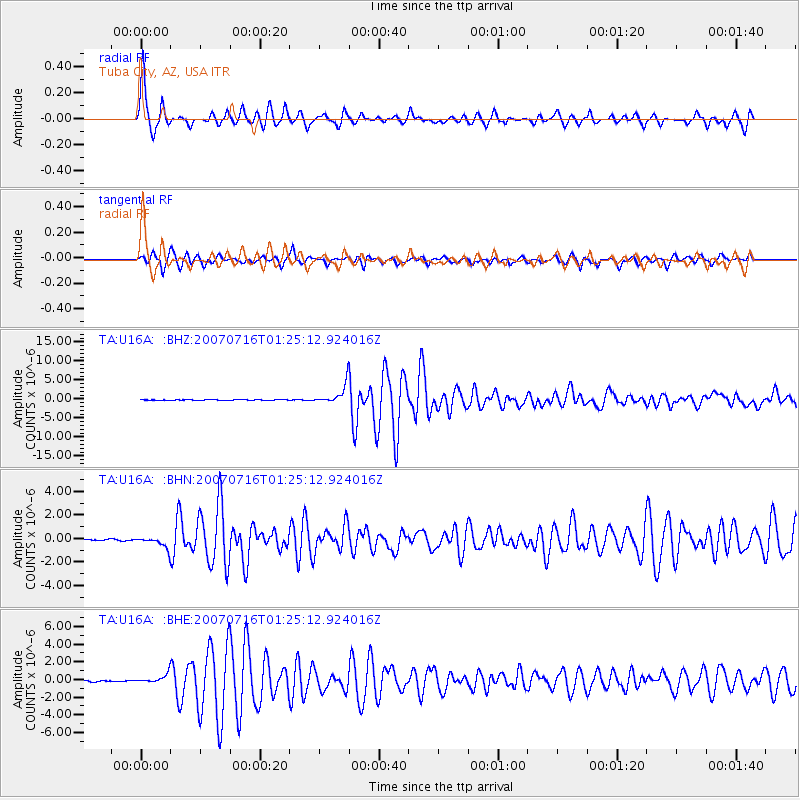
Earthquake location: Near West Coast Of Honshu, Japan
Earthquake latitude/longitude: 37.5/138.4
Earthquake time(UTC): 2007/07/16 (197) 01:13:22 GMT
Earthquake Depth: 12 km
Earthquake Magnitude: 6.5 MB, 6.4 MS, 6.6 MW, 6.5 MW
Earthquake Catalog/Contributor: WHDF/NEIC
Network: TA USArray Transportable Network (new EarthScope stations)
Station: U16A Tuba City, AZ, USA
Lat/Lon: 36.14 N/111.13 W
Elevation: 1544 m
Distance: 82.4 deg
Az: 49.926 deg
Baz: 311.278 deg
Ray Param: 0.04688777
Estimated Moho Depth: 27.75 km
Estimated Crust Vp/Vs: 1.81
Assumed Crust Vp: 6.247 km/s
Estimated Crust Vs: 3.461 km/s
Estimated Crust Poisson's Ratio: 0.28
Radial Match: 95.5981 %
Radial Bump: 400
Transverse Match: 93.42659 %
Transverse Bump: 400
SOD ConfigId: 2564
Insert Time: 2010-03-06 01:09:11.789 +0000
GWidth: 2.5
Max Bumps: 400
Tol: 0.001

Signal To Noise

ChannelStoNSTALTA
TA:U16A: :BHN:20070716T01:25:12.924016Z11.6849654.5450733E-73.8896765E-8
TA:U16A: :BHE:20070716T01:25:12.924016Z8.5111324.9162924E-75.776308E-8
TA:U16A: :BHZ:20070716T01:25:12.924016Z47.9990162.546354E-65.305013E-8
Arrivals
Ps3.7 SECOND
PpPs12 SECOND
PsPs/PpSs16 SECOND