You are here: Home > Network List > AV - Alaska Volcano Observatory Stations List
> Station AMKA Regional Station, Amchitka Island, Alaska > Earthquake Result Viewer
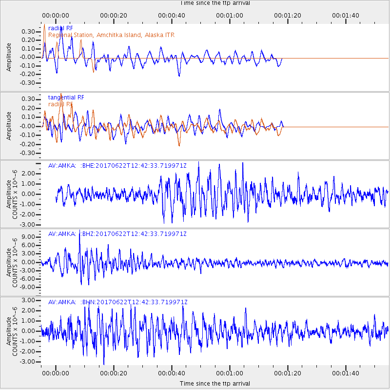
AMKA Regional Station, Amchitka Island, Alaska - Earthquake Result Viewer
*The percent match for this event was below the threshold and hence no stack was calculated.
| Earthquake location: |
Near Coast Of Guatemala |
| Earthquake latitude/longitude: |
13.7/-91.1 |
| Earthquake time(UTC): |
2017/06/22 (173) 12:31:04 GMT |
| Earthquake Depth: |
10 km |
| Earthquake Magnitude: |
6.8 Mi |
| Earthquake Catalog/Contributor: |
NEIC PDE/at |
|
| Network: |
AV Alaska Volcano Observatory |
| Station: |
AMKA Regional Station, Amchitka Island, Alaska |
| Lat/Lon: |
51.38 N/179.30 E |
| Elevation: |
116 m |
|
| Distance: |
79.2 deg |
| Az: |
320.353 deg |
| Baz: |
81.677 deg |
| Ray Param: |
$rayparam |
*The percent match for this event was below the threshold and hence was not used in the summary stack. |
|
| Radial Match: |
73.81121 % |
| Radial Bump: |
400 |
| Transverse Match: |
84.013214 % |
| Transverse Bump: |
400 |
| SOD ConfigId: |
13570011 |
| Insert Time: |
2019-04-28 06:09:24.403 +0000 |
| GWidth: |
2.5 |
| Max Bumps: |
400 |
| Tol: |
0.001 |
|
Signal To Noise
| Channel | StoN | STA | LTA |
| AV:AMKA: :BHZ:20170622T12:42:33.719971Z | 6.5614624 | 2.9632688E-6 | 4.5161713E-7 |
| AV:AMKA: :BHN:20170622T12:42:33.719971Z | 1.5572933 | 6.3750537E-7 | 4.0936754E-7 |
| AV:AMKA: :BHE:20170622T12:42:33.719971Z | 2.6323195 | 1.0193978E-6 | 3.8726222E-7 |
| Arrivals |
| Ps | |
| PpPs | |
| PsPs/PpSs | |


