You are here: Home > Network List > CI - Caltech Regional Seismic Network Stations List
> Station SMM Simmler, CA, USA > Earthquake Result Viewer
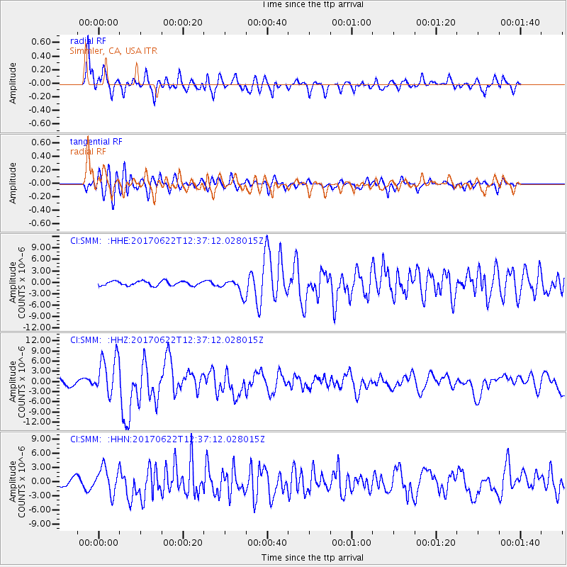
SMM Simmler, CA, USA - Earthquake Result Viewer
*The percent match for this event was below the threshold and hence no stack was calculated.
| Earthquake location: |
Near Coast Of Guatemala |
| Earthquake latitude/longitude: |
13.7/-91.1 |
| Earthquake time(UTC): |
2017/06/22 (173) 12:31:04 GMT |
| Earthquake Depth: |
10 km |
| Earthquake Magnitude: |
6.8 Mi |
| Earthquake Catalog/Contributor: |
NEIC PDE/at |
|
| Network: |
CI Caltech Regional Seismic Network |
| Station: |
SMM Simmler, CA, USA |
| Lat/Lon: |
35.31 N/120.00 W |
| Elevation: |
599 m |
|
| Distance: |
33.8 deg |
| Az: |
314.681 deg |
| Baz: |
122.327 deg |
| Ray Param: |
$rayparam |
*The percent match for this event was below the threshold and hence was not used in the summary stack. |
|
| Radial Match: |
85.149704 % |
| Radial Bump: |
400 |
| Transverse Match: |
72.38693 % |
| Transverse Bump: |
400 |
| SOD ConfigId: |
13570011 |
| Insert Time: |
2019-04-28 06:11:34.865 +0000 |
| GWidth: |
2.5 |
| Max Bumps: |
400 |
| Tol: |
0.001 |
|
Signal To Noise
| Channel | StoN | STA | LTA |
| CI:SMM: :HHZ:20170622T12:37:12.028015Z | 7.148337 | 5.9675126E-6 | 8.348113E-7 |
| CI:SMM: :HHN:20170622T12:37:12.028015Z | 2.48211 | 2.8574514E-6 | 1.1512186E-6 |
| CI:SMM: :HHE:20170622T12:37:12.028015Z | 5.664364 | 3.3293393E-6 | 5.877693E-7 |
| Arrivals |
| Ps | |
| PpPs | |
| PsPs/PpSs | |


