U13A Pakoon Wash, AZ, USA - Earthquake Result Viewer
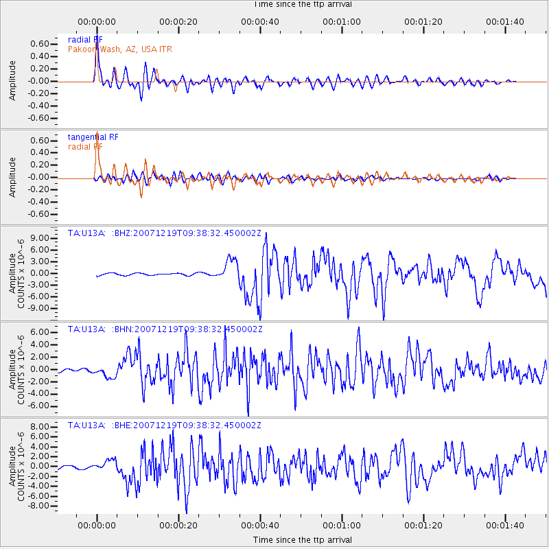
Earthquake location: Andreanof Islands, Aleutian Is.
Earthquake latitude/longitude: 51.4/-179.5
Earthquake time(UTC): 2007/12/19 (353) 09:30:27 GMT
Earthquake Depth: 29 km
Earthquake Magnitude: 6.4 MB, 7.1 MS, 7.1 MW, 7.0 MW
Earthquake Catalog/Contributor: WHDF/NEIC
Network: TA USArray Transportable Network (new EarthScope stations)
Station: U13A Pakoon Wash, AZ, USA
Lat/Lon: 36.42 N/113.97 W
Elevation: 712 m
Distance: 48.0 deg
Az: 81.441 deg
Baz: 309.774 deg
Ray Param: 0.06961297
Estimated Moho Depth: 47.75 km
Estimated Crust Vp/Vs: 1.89
Assumed Crust Vp: 6.194 km/s
Estimated Crust Vs: 3.277 km/s
Estimated Crust Poisson's Ratio: 0.31
Radial Match: 90.76615 %
Radial Bump: 400
Transverse Match: 79.359184 %
Transverse Bump: 400
SOD ConfigId: 2564
Insert Time: 2010-03-06 01:10:41.949 +0000
GWidth: 2.5
Max Bumps: 400
Tol: 0.001

Signal To Noise

ChannelStoNSTALTA
TA:U13A: :BHN:20071219T09:38:32.450002Z3.75122939.1586696E-72.4415115E-7
TA:U13A: :BHE:20071219T09:38:32.450002Z2.86356831.1667038E-64.0743006E-7
TA:U13A: :BHZ:20071219T09:38:32.450002Z9.8475232.8037264E-62.8471385E-7
Arrivals
Ps7.2 SECOND
PpPs21 SECOND
PsPs/PpSs28 SECOND