You are here: Home > Network List > CN - Canadian National Seismograph Network Stations List
> Station INK INUVIK, NT > Earthquake Result Viewer
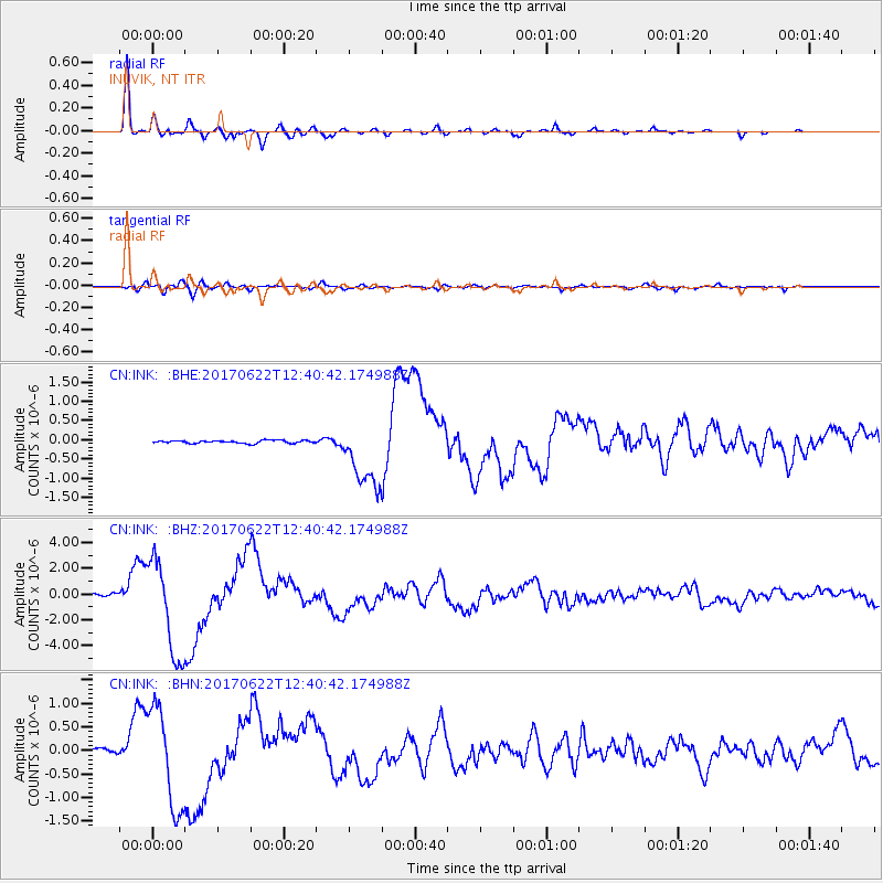
INK INUVIK, NT - Earthquake Result Viewer
*The percent match for this event was below the threshold and hence no stack was calculated.
| Earthquake location: |
Near Coast Of Guatemala |
| Earthquake latitude/longitude: |
13.7/-91.1 |
| Earthquake time(UTC): |
2017/06/22 (173) 12:31:04 GMT |
| Earthquake Depth: |
10 km |
| Earthquake Magnitude: |
6.8 Mi |
| Earthquake Catalog/Contributor: |
NEIC PDE/at |
|
| Network: |
CN Canadian National Seismograph Network |
| Station: |
INK INUVIK, NT |
| Lat/Lon: |
68.31 N/133.53 W |
| Elevation: |
44 m |
|
| Distance: |
61.0 deg |
| Az: |
343.331 deg |
| Baz: |
131.422 deg |
| Ray Param: |
$rayparam |
*The percent match for this event was below the threshold and hence was not used in the summary stack. |
|
| Radial Match: |
97.71859 % |
| Radial Bump: |
303 |
| Transverse Match: |
81.03627 % |
| Transverse Bump: |
400 |
| SOD ConfigId: |
13570011 |
| Insert Time: |
2019-04-28 06:12:10.828 +0000 |
| GWidth: |
2.5 |
| Max Bumps: |
400 |
| Tol: |
0.001 |
|
Signal To Noise
| Channel | StoN | STA | LTA |
| CN:INK: :BHZ:20170622T12:40:42.174988Z | 36.625217 | 3.845475E-6 | 1.0499529E-7 |
| CN:INK: :BHN:20170622T12:40:42.174988Z | 23.781395 | 1.0729422E-6 | 4.5116874E-8 |
| CN:INK: :BHE:20170622T12:40:42.174988Z | 27.311258 | 1.3483519E-6 | 4.936982E-8 |
| Arrivals |
| Ps | |
| PpPs | |
| PsPs/PpSs | |


