U13A Pakoon Wash, AZ, USA - Earthquake Result Viewer
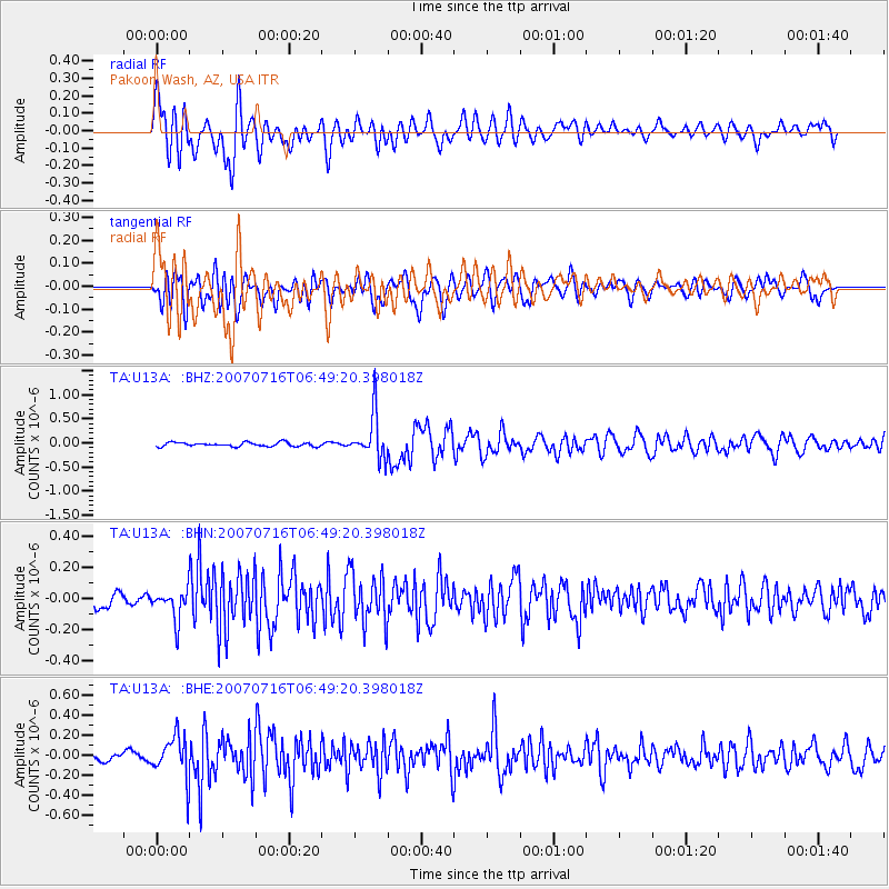
Earthquake location: Near West Coast Of Honshu, Japan
Earthquake latitude/longitude: 37.5/138.5
Earthquake time(UTC): 2007/07/16 (197) 06:37:40 GMT
Earthquake Depth: 15 km
Earthquake Magnitude: 5.7 MB, 5.1 MS, 5.7 MW, 5.6 MW
Earthquake Catalog/Contributor: WHDF/NEIC
Network: TA USArray Transportable Network (new EarthScope stations)
Station: U13A Pakoon Wash, AZ, USA
Lat/Lon: 36.42 N/113.97 W
Elevation: 712 m
Distance: 80.5 deg
Az: 51.229 deg
Baz: 309.762 deg
Ray Param: 0.04820984
Estimated Moho Depth: 16.25 km
Estimated Crust Vp/Vs: 2.03
Assumed Crust Vp: 6.194 km/s
Estimated Crust Vs: 3.051 km/s
Estimated Crust Poisson's Ratio: 0.34
Radial Match: 80.53557 %
Radial Bump: 400
Transverse Match: 74.81692 %
Transverse Bump: 400
SOD ConfigId: 2564
Insert Time: 2010-03-06 01:11:25.035 +0000
GWidth: 2.5
Max Bumps: 400
Tol: 0.001

Signal To Noise

ChannelStoNSTALTA
TA:U13A: :BHN:20070716T06:49:20.398018Z1.9978499.487183E-84.7486985E-8
TA:U13A: :BHE:20070716T06:49:20.398018Z5.03770642.0601358E-74.089432E-8
TA:U13A: :BHZ:20070716T06:49:20.398018Z11.400324.5694458E-74.008173E-8
Arrivals
Ps2.8 SECOND
PpPs7.8 SECOND
PsPs/PpSs11 SECOND